Holmes County, Ohio
| Holmes County | |
| County | |
Holmes Countys domstolshus i Millersburg. | |
| Land | |
|---|---|
| Delstat | |
| Huvudort | Millersburg |
| Area | 1 098 km² (2010)[1] |
| - land | 1 094 km² (100%) |
| - vatten | 3,7 km² (0%) |
| Folkmängd | 42 366 (2010)[2] |
| Befolkningstäthet | 39 invånare/km² |
| Grundat | 20 januari 1824 |
| Tidszon | EST (UTC-5) |
| - sommartid | EDT (UTC-4) |
| FIPS-kod | 39075 |
| Geonames | 5157783 |
Läge i delstaten Ohio. | |
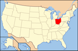
Delstatens läge i USA. | |
Holmes County, grundat 20 januari 1824, är ett county i delstaten Ohio i USA. Den administrativa huvudorten (county seat) är Millersburg.
Holmes County hade vid 2020 års folkräkning 44 223 invånare och är det område som flest Amishfolk lever i. Det har fått sitt namn efter Andrew Holmes, som dödades år 1814 i 1812 års krig.
Geografi
Enligt United States Census Bureau så har countyt en total area på 1 098 km². 1 095 km² av den arean är land och 3 km² är vatten.
Angränsande countyn
- Wayne County - nord
- Stark County - nordöst
- Tuscarawas County - öst
- Coshocton County - syd
- Knox County - sydväst
- Ashland County - nordväst
Byar
- Glenmont (283 invånare)
- Holmesville (386 invånare)
- Killbuck (839 invånare)
- Millersburg (3326 invånare)
- Nashville (172 invånare)
Källor
- ^ ”2010 Census U.S. Gazetteer Files for Counties”. U.S. Census Bureau. Arkiverad från originalet den 5 juli 2012. https://www.webcitation.org/68vYLbou5?url=http://www.census.gov/geo/www/gazetteer/files/Gaz_counties_national.txt. Läst 5 juli 2012.
- ^ ”State & County QuickFacts, Holmes County, Ohio” (på engelska). U.S. Census Bureau. Arkiverad från originalet den 11 juli 2011. https://www.webcitation.org/606XN443q?url=http://quickfacts.census.gov/qfd/states/39/39075.html. Läst 6 juli 2011.
Externa länkar
 Wikimedia Commons har media som rör Holmes County, Ohio.
| ||||||||||
Media som används på denna webbplats
Författare/Upphovsman: This version: uploader
Base versions this one is derived from: originally created by en:User:Wapcaplet, Licens: CC BY 2.0
Map of USA with Ohio highlighted
Front of the Holmes County Courthouse, located on Courthouse Square in Millersburg, Ohio, United States. Built in 1880, it is listed with the county jail on the National Register of Historic Places. Notice the statue of Ulysses S. Grant on the left side of the picture.
This is a locator map showing Holmes County in Ohio. For more information, see Commons:United States county locator maps.


