Gallia County
| Gallia County | |
| County | |
Gallia Countys domstolshus i Gallipolis. | |
| Land | |
|---|---|
| Delstat | |
| Huvudort | Gallipolis |
| Area | 1 220 km² (2010)[1] |
| - land | 1 208 km² (99%) |
| - vatten | 12,1 km² (1%) |
| Folkmängd | 30 934 (2010)[2] |
| Befolkningstäthet | 26 invånare/km² |
| Grundat | 25 mars 1803 |
| - uppkallat efter | Gallien |
| Tidszon | EST (UTC-5) |
| - sommartid | EDT (UTC-4) |
| FIPS-kod | 39053 |
| Geonames | 4512438 |
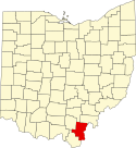
Läge i delstaten Ohio. | |
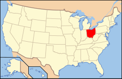
Delstatens läge i USA. | |
| Webbplats: https://www.gallianet.net/ | |
| Fotnoter: Naco - Find a county | |
Gallia County är ett administrativt område i delstaten Ohio, USA. År 2010 hade countyt 30 934 invånare. Den administrativa huvudorten (county seat) är Gallipolis.
Geografi
Enligt United States Census Bureau har countyt en total area på 1 220 km². 1 214 km² av den arean är land och 6 km² är vatten.
Angränsande countyn
- Vinton County - nord
- Meigs County - nordost
- Mason County, West Virginia - öst
- Cabell County, West Virginia - syd
- Lawrence County - sydväst
- Jackson County - nordväst
Källor
- ^ ”2010 Census U.S. Gazetteer Files for Counties”. U.S. Census Bureau. Arkiverad från originalet den 5 juli 2012. https://www.webcitation.org/68vYLbou5?url=http://www.census.gov/geo/www/gazetteer/files/Gaz_counties_national.txt. Läst 5 juli 2012.
- ^ ”State & County QuickFacts, Gallia County, Ohio” (på engelska). U.S. Census Bureau. Arkiverad från originalet den 10 juli 2011. https://www.webcitation.org/604Ss9A0x?url=http://quickfacts.census.gov/qfd/states/39/39053.html. Läst 6 juli 2011.
| ||||||||||
|
Media som används på denna webbplats
Författare/Upphovsman: This version: uploader
Base versions this one is derived from: originally created by en:User:Wapcaplet, Licens: CC BY 2.0
Map of USA with Ohio highlighted
Front and southeastern end of the Gallia County Courthouse, located at 18 Locust Street in Gallipolis, Ohio, United States. Built in 1985, it is the county's fifth courthouse; the first was demolished by the county government, while the second, third, and fourth were all destroyed by fire.
This is a locator map showing Gallia County in Ohio. For more information, see Commons:United States county locator maps.


