Union County, Ohio
| Union County | |||
| County | |||
Domstolsbyggnaden i Union County. | |||
| |||
| Land | |||
|---|---|---|---|
| Delstat | |||
| Huvudort | Marysville | ||
| Största stad | Marysville | ||
| Area | 1 131 km² (2010)[1] | ||
| - land | 1 118 km² (99%) | ||
| - vatten | 13,3 km² (1%) | ||
| Folkmängd | 52 300 (2010)[2] | ||
| Befolkningstäthet | 47 invånare/km² | ||
| Grundat | 1820 | ||
| Tidszon | EST (UTC-5) | ||
| - sommartid | EDT (UTC-4) | ||
| FIPS-kod | 39159 | ||
| Geonames | 5174669 | ||
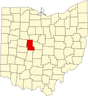
Läge i delstaten Ohio. | |||
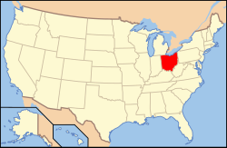
Delstatens läge i USA. | |||
| Fotnoter: Naco - Find a county | |||
Union County är ett administrativt område i delstaten Ohio, USA, med 52 300 invånare. Den administrativa huvudorten (county seat) är Marysville.
Geografi
Enligt United States Census Bureau har countyt en total area på 1 132 km². 1 131 km² av den arean är land och 1 km² är vatten.
Angränsande countyn
- Marion County - nordost
- Delaware County - öst
- Franklin County - sydost
- Madison County - söder
- Champaign County - sydväst
- Logan County - väst
- Hardin County - nordväst
Städer och samhällen
- Dublin (delvis i Delaware County, delvis i Franklin County)
- Magnetic Springs
- Marysville (huvudort)
- Milford Center
- Mowrystown
- Plain City (delvis i Madison County)
- Richwood
- Unionville Center
Källor
- ^ ”2010 Census U.S. Gazetteer Files for Counties”. U.S. Census Bureau. Arkiverad från originalet den 5 juli 2012. https://www.webcitation.org/68vYLbou5?url=http://www.census.gov/geo/www/gazetteer/files/Gaz_counties_national.txt. Läst 5 juli 2012.
- ^ ”State & County QuickFacts, Union County, Ohio” (på engelska). U.S. Census Bureau. Arkiverad från originalet den 22 juli 2011. https://www.webcitation.org/60MOPvlqn?url=http://quickfacts.census.gov/qfd/states/39/39159.html. Läst 6 juli 2011.
| ||||||||||
|
Media som används på denna webbplats
Författare/Upphovsman: This version: uploader
Base versions this one is derived from: originally created by en:User:Wapcaplet, Licens: CC BY 2.0
Map of USA with Ohio highlighted
This is a locator map showing Union County in Ohio. For more information, see Commons:United States county locator maps.
Författare/Upphovsman: M.Jovellanos, Licens: CC BY-SA 3.0
Flag of Union County, Ohio. Information about the flag's design and history can be found at the Ohio Statehouse website.
(c) Wiki Historian N OH of English Wikipedia, CC BY-SA 3.0
Union County Courthouse, Marysville, Ohio, United States
Seal of Union County Ohio


