Akron, Ohio
| Akron | |
| Stad | |
| Officiellt namn: City of Akron | |
| Smeknamn: Rubber City, City of Invention | |
| Land | |
|---|---|
| Delstat | |
| County | Summit County |
| Höjdläge | 306 m ö.h. |
| Koordinater | 41°04′23″N 81°31′04″V / 41.07306°N 81.51778°V |
| Area | 161,54 km² |
| - land | 160,66 km² |
| - vatten | 0,88 km² |
| Folkmängd | 199 110 (2010) |
| - urban area | 569 499 |
| - metropolitan area | 705 686 |
| Befolkningstäthet | 1 239 invånare/km² |
| Grundad | 1825 |
| - Stadsprivilegier | 1836 (samhälle) 1865 (stad) |
| Borgmästare | Dan Horrigan (D) |
| Tidszon | EST (UTC-5) |
| - sommartid | EDT (UTC-4) |
| Postnummer | Lista 44301-44321, 44325, 44326, 44328, 44333, 44334, 44372, 44396, 44398 |
| Riktnummer | 234, 330 |
| FIPS-kod | 39-01000 |
| GNIS-kod | 1064305 [1] |
| Geonames | 5145476 |
Ortens läge i Ohio | |
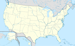
Akrons läge i USA | |
| Webbplats: akronohio.gov | |

Akron är en stad i Summit County i delstaten Ohio i USA. Staden grundades 1825 och har med förorter inräknat 703 200 invånare (2010). Akron är administrativ huvudort (county seat) i Summit County.
Akron är känt för sin stora däckindustri med storföretagen Goodyear och Firestone. I Akron bildades Anonyma Alkoholister 1935.
Befolkningsutveckling
| Akron, Ohio Invånare per år | ||
| År | Invånare | |
|---|---|---|
| 1900 | 42 728 | |
| 1910 | 69 067 | |
| 1920 | 208 435 | |
| 1930 | 255 040 | |
| 1940 | 244 791 | |
| 1950 | 274 605 | |
| 1960 | 290 351 | |
| 1970 | 275 425 | |
| 1980 | 237 177 | |
| 1990 | 223 019 | |
| 2000 | 217 074 | |
| 2010 | 199 110 | |
Kända personer
Några kända personer som är födda i Akron:
- Willard Van Orman Quine (1908–2000), filosof och logiker
- Shirley Fry (född 1927), tennisspelare
- John Dean (född 1938), jurist, juridisk rådgivare till president Richard Nixon
- David Allan Coe (född 1939), countrymusiker
- Richard Smalley (1943–2005), kemist, nobelpristagare 1996
- Ray Wise (född 1947), skådespelare
- Chrissie Hynde (född 1951), rockmusiker
- Jim Jarmusch (född 1953), regissör
- Melina Kanakaredes (född 1967), skådespelare
- Tim Owens (född 1967), artist
- Heather Kozar (född 1976), fotomodell
- Dan Auerbach (född 1979), musiker, medlem i The Black Keys
- Patrick Carney (född 1980), musiker, medlem i The Black Keys
- LeBron James (född 1984), basketspelare
- Stephen Curry (född 1988), basketspelare
Referenser
- ^ ”US Board on Geographic Names”. US Board on Geographic Names. United States Geological Survey. October 25, 2007. Arkiverad från originalet den February 26, 2012. https://www.webcitation.org/65jET5cdV?url=http://geonames.usgs.gov/. Läst 31 januari 2008.
Externa länkar
 Wikimedia Commons har media som rör Akron, Ohio.
- Officiell webbplats (engelska)
| ||||||||||
|
Media som används på denna webbplats
Shiny red button/marker widget. Used to mark the location of something such as a tourist attraction.
Författare/Upphovsman: User:OHWiki, Licens: CC BY-SA 2.5
This photograph of downtown Akron, Ohio looking south was taken by User OHWiki.
Författare/Upphovsman: TUBS
Location map of the USA (Hawaii and Alaska shown in sidemaps).
Main map: EquiDistantConicProjection : Central parallel :
* N: 37.0° N
Central meridian :
* E: 96.0° W
Standard parallels:
* 1: 32.0° N
* 2: 42.0° N
Made with Natural Earth. Free vector and raster map data @ naturalearthdata.com.
Formulas for x and y:
x = 50.0 + 124.03149777329222 * ((1.9694462586094064-({{{2}}}* pi / 180))
      * sin(0.6010514667026994 * ({{{3}}} + 96) * pi / 180))
y = 50.0 + 1.6155950752393982 * 124.03149777329222 * 0.02613325650382181
      - 1.6155950752393982  * 124.03149777329222 *
     (1.3236744353715044  - (1.9694462586094064-({{{2}}}* pi / 180))
      * cos(0.6010514667026994 * ({{{3}}} + 96) * pi / 180))
Hawaii side map: Equirectangular projection, N/S stretching 107 %. Geographic limits of the map:
- N: 22.4° N
- S: 18.7° N
- W: 160.7° W
- E: 154.6° W
Alaska side map: Equirectangular projection, N/S stretching 210.0 %. Geographic limits of the map:
- N: 72.0° N
- S: 51.0° N
- W: 172.0° E
- E: 129.0° W
Författare/Upphovsman: Rcsprinter123, Licens: CC BY 3.0
Map showing the location of this city within Summit County, Ohio. Data source: 2010 U.S. census


