Katy, Texas
| Katy | |
| city | |
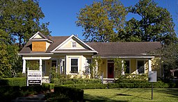
(c) Larry D. Moore, CC BY 4.0 Stewart House | |
| Land | |
|---|---|
| Delstat | Texas |
| County | Fort Bend County Harris County Waller County |
| Höjdläge | 43 m ö.h. |
| Koordinater | 29°47′9″N 95°49′28″V / 29.78583°N 95.82444°V |
| Yta | 29 km² (2010) |
| - land | 29 km² |
| - vatten | 0 km² |
| Folkmängd | 14 102 (2010) |
| Befolkningstäthet | 486 invånare/km² |
| Tidszon | CST (UTC-6) |
| - sommartid | CDT (UTC-5) |
| ZIP-kod | 77400–77499 |
| Riktnummer | 281 |
| FIPS | 4838476 |
| Geonames | 4702732 |
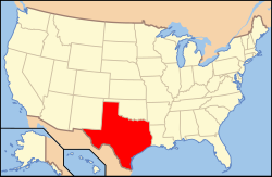
Ortens läge i Texas | |
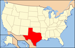
Texas läge i USA | |
| Webbplats: https://www.cityofkaty.com/ | |
Katy är en stad (city) i Fort Bend County, Harris County och Waller County i Texas.[1] Vid 2010 års folkräkning hade Katy 14 102 invånare.[2]
Källor
- ^ Katy, TX. Map Quest. Läst 20 februari 2020.
- ^ 2010 Census Population of Katy, Texas Arkiverad 20 februari 2020 hämtat från the Wayback Machine.. Census Viewer. Läst 20 februari 2020.
|
Media som används på denna webbplats
Shiny red button/marker widget. Used to mark the location of something such as a tourist attraction.
Författare/Upphovsman: This version: uploader
Base versions this one is derived from: originally created by en:User:Wapcaplet, Licens: CC BY 2.0
Map of USA with Texas highlighted
(c) Larry D. Moore, CC BY 4.0
The Dr. James M. and Dove Stewart House in Katy, Texas, United States. The upper window is still boarded up from Hurricane Ike. The house was listed on the National Register of Historic Places on February 16, 1996.
Författare/Upphovsman: Alexrk, Licens: CC BY 3.0
Den här Det karta skapades med GeoTools.


