Fort Bend County
| Fort Bend County | |
| County | |
| Land | |
|---|---|
| Delstat | |
| Huvudort | Richmond |
| Största stad | Sugar Land |
| Area | 2 293 km² (2010)[1] |
| - land | 2 231 km² (97%) |
| - vatten | 61,8 km² (3%) |
| Folkmängd | 585 375 (2010)[2] |
| Befolkningstäthet | 262 invånare/km² |
| Grundat | 1837 |
| Tidszon | CST (UTC-6) |
| - sommartid | CDT (UTC-5) |
| FIPS-kod | 48157 |
| Geonames | 4691851 |
Läge i delstaten Texas. | |
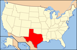
Delstatens läge i USA. | |
Fort Bend är ett county nära kusten i området Greater Houston i Texas. Den administrativa huvudorten (county seat) är Richmond. År 2005 bodde här 463 650 personer vilket var en ökning med 30 procent sedan år 2000. Befolkningen beräknas tredubblas fram till 2040.
Geografi
Enligt United States Census Bureau har countyt en total area på 2 295 km². 2 265 km² av den arean är land och 30 km² är vatten.
Angränsande countyn
- Waller County - norr
- Harris County - nordost
- Austin County - nordväst
- Brazoria County - sydost
- Wharton County - sydväst
Städer
I countyt finns tolv städer eller delar av städer.
|
|
| ||||||||||
Källor
- ^ ”2010 Census U.S. Gazetteer Files for Counties”. U.S. Census Bureau. Arkiverad från originalet den 5 juli 2012. https://www.webcitation.org/68vYLbou5?url=http://www.census.gov/geo/www/gazetteer/files/Gaz_counties_national.txt. Läst 5 juli 2012.
- ^ ”State & County QuickFacts, Fort Bend County, Texas” (på engelska). U.S. Census Bureau. Arkiverad från originalet den 10 juli 2011. https://www.webcitation.org/604BddyKf?url=http://quickfacts.census.gov/qfd/states/48/48157.html. Läst 6 juli 2011.
Media som används på denna webbplats
Författare/Upphovsman: Robert Yarnall Richie , Licens: No restrictions
Title: [Fort Bend County Court House, Richmond, Texas]
Creator: Richie, Robert Yarnall, 1908-1984
Date: February 1948
Series: Series 6: Negatives and Color Transparencies
Negative Series: 3000
Part of: Robert Yarnall Richie photograph collection
Place: Richmond, Fort Bend County, Texas
Physical Description: 1 negative: film, black and white; 12.6 x 17.7 cm
File: ag1982_0234_3000_07_richmondtex_sm_opt.jpg
Rights: Please cite Southern Methodist University, Central University Libraries, DeGolyer Library when using this image file. A high-quality version of this file may be obtained for a fee by contacting degolyer@smu.edu.
For more information and to view the image in high resolution, see: digitalcollections.smu.edu/cdm/ref/collection/ryr/id/2884/
This is a locator map showing Fort Bend County in Texas. For more information, see Commons:United States county locator maps.
Författare/Upphovsman: This version: uploader
Base versions this one is derived from: originally created by en:User:Wapcaplet, Licens: CC BY 2.0
Map of USA with Texas highlighted


