Zaire (provins)
| Den här artikeln behöver källhänvisningar för att kunna verifieras. (2023-04) Åtgärda genom att lägga till pålitliga källor (gärna som fotnoter). Uppgifter utan källhänvisning kan ifrågasättas och tas bort utan att det behöver diskuteras på diskussionssidan. |
| Zaire | |
| Provins | |
Typiskt landskap | |
| Land | |
|---|---|
| Koordinater | 6°35′14″S 13°31′11″Ö / 6.58717°S 13.51966°Ö |
| Mbanza-Kongo | |
| Area | 40 130 km² |
| Folkmängd | 567 225från enwiki |
| Befolkningstäthet | 14 invånare/km² |
| Tidszon | WAT (UTC+1) |
| ISO 3166-2-kod | AO-ZAI- |
| Geonames | 2236355 |

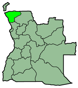
Zaire är en provins i nordvästra Angola med en yta på 40 130 km² och omkring 600 000 invånare. Delstatens huvudstad är M'Banza Kongo.
| |||||||
Media som används på denna webbplats
Författare/Upphovsman: Tkgd2007, Licens: CC BY-SA 3.0
A new incarnation of Image:Question_book-3.svg, which was uploaded by user AzaToth. This file is available on the English version of Wikipedia under the filename en:Image:Question book-new.svg
Shiny red button/marker widget. Used to mark the location of something such as a tourist attraction.
Författare/Upphovsman: Sascha Noyes, Licens: CC BY-SA 3.0
Mapa de Angola resaltando la provincia
Författare/Upphovsman: Uwe Dedering, Licens: CC BY-SA 3.0
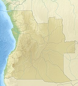
Relief location map of Angola.
- Projection: Equirectangular projection, strechted by 102.0%.
- Geographic limits of the map:
- N: -4.1° N
- S: -18.5° N
- W: 11.1° E
- E: 24.5° E
- GMT projection: -JX21.4376cd/23.498169313432836cd
- GMT region: -R11.1/-18.5/24.5/-4.1r
- GMT region for grdcut: -R11.1/-18.5/24.5/-4.1r
- Relief: SRTM30plus.
- Made with Natural Earth. Free vector and raster map data @ naturalearthdata.com.


