World Monuments Watch List 2020

World Monuments Watch List 2020 är 2020 års utgåva av den lista över hotade kulturminnen från hela världen, som utges vartannat år av World Monuments Fund.


ObjektBildPlatsKoordinater
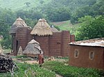
Koutammakou, Batammaristammens landBenin och Togo10°6′0″N 1°4′0″Ö / 10.10000°N 1.06667°Ö / 10.10000; 1.06667
Ontario PlaceToronto, Kanada43°37′44″N 79°25′01″V / 43.629°N 79.417°V / 43.629; -79.417
OrongoPåskön, Chile27°7′S 109°22′V / 27.117°S 109.367°V / -27.117; -109.367
Alexan Pashas palatsAsyut, Egypten27°11′20″N 31°11′31″Ö / 27.18889°N 31.19194°Ö / 27.18889; 31.19194
Notre-Dame de Paris
(c) Peter Haas, CC BY-SA 3.0
Paris, Frankrike48°51′11″N 2°20′59″Ö / 48.85306°N 2.34972°Ö / 48.85306; 2.34972
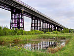
Bennerley ViaductDerbyshireNottinghamshire, Storbritannien52°59′20″N 1°17′59″V / 52.988776°N 1.299691°V / 52.988776; -1.299691
Tusheti nationalparkGeorgien42°24′36″N 45°29′13″Ö / 42.41000°N 45.48694°Ö / 42.41000; 45.48694
Gingerbread-kvarteren i Port-au-PrincePort-au-Prince, Haiti18°31′46″N 72°20′15″V / 18.52944°N 72.33750°V / 18.52944; -72.33750
Gamla vattenförsörjningssystem på DeccanplatånKarnataka och Maharashtra, Indien16°49′30″N 75°42′36″Ö / 16.82500°N 75.71000°Ö / 16.82500; 75.71000
Sardar Vallabhbhai Patel StadiumAhmedabad, Indien23°5′30″N 72°35′51″Ö / 23.09167°N 72.59750°Ö / 23.09167; 72.59750
Mam RashanhelgedomenIrak36°41′N 43°26′Ö / 36.683°N 43.433°Ö / 36.683; 43.433
Inari-yu badhusKita, Tokyo, Japan35°44′41″N 139°43′28″Ö / 35.74472°N 139.72444°Ö / 35.74472; 139.72444
IwamatsuUwajima, Ehime prefektur, Japan33°07′23″N 132°31′11″Ö / 33.12306°N 132.51972°Ö / 33.12306; 132.51972
Canal nacionalCiudad de México, Mexiko19°19′10″N 99°05′58″V / 19.31944°N 99.09944°V / 19.31944; -99.09944
Traditionella burmesiska landsbygdshus i teakMyanmar22°45′N 95°58′Ö / 22.750°N 95.967°Ö / 22.750; 95.967
Chojin LamatempelUlan Bator, Mongoliet47°54′54″N 106°55′06″Ö / 47.91500°N 106.91833°Ö / 47.91500; 106.91833
Böneplatser i KatmandudalenNepal25°26′N 85°18′Ö / 25.433°N 85.300°Ö / 25.433; 85.300
Anakalibasaren i LahoreLahore, Pakistan31°34′0″N 74°18′58″Ö / 31.56667°N 74.31611°Ö / 31.56667; 74.31611
UrubambadalenCusco, Peru13°20′S 72°05′V / 13.333°S 72.083°V / -13.333; -72.083
Kindlerkapellet, Pabianice lutherska kyrkogårdPabianice, Polen51°39′17″N 19°21′19″Ö / 51.65472°N 19.35528°Ö / 51.65472; 19.35528
Atriumhus i Axerquía i CördobaCórdoba, Spanien37°53′18″N 4°48′44″V / 37.88833°N 4.81222°V / 37.88833; -4.81222
Bears Ears National MonumentUtah, USA37°37′47″N 109°52′03″V / 37.62961°N 109.86760°V / 37.62961; -109.86760
Bostadsområden i AguirreAguirre, Puerto Rico17°57′09″N 66°15′36″V / 17.95250°N 66.26000°V / 17.95250; -66.26000
San Antonio Woolworth BuildingSan Antonio, Texas, USA29°25′34″N 98°29′17″V / 29.42611°N 98.48806°V / 29.42611; -98.48806
Hus i den gamla judiska stadsdelen i BucharaBuchara, Uzbekistan39°46′05″N 64°25′01″Ö / 39.76806°N 64.41694°Ö / 39.76806; 64.41694

Källor

Media som används på denna webbplats

Pabianice kaplica Kindlerow 2(pischmak).JPG
Författare/Upphovsman: Paweł Schmidt, Licens: CC BY-SA 3.0 pl
This is a photo of a monument in Poland identified in WLM database by the ID
Canal Nacional.JPG
Författare/Upphovsman: Yavidaxiu, Licens: CC BY-SA 3.0
Vista del canal Nacional desde el puente del Toro del pueblo de San Andrés Tomatlán, en el límite entre las delegaciones de Iztapalapa y Coyoacán (Distrito Federal, México).
Bennerley Viaduct Ilkeston.jpg
Författare/Upphovsman: Grant Shaw, Licens: CC BY-SA 3.0
Bennerley Viaduct near Ilkeston, Derbyshire is one of only two surviving wrought iron railway viaducts in the United Kingdom.
Tushethi5.jpg
Författare/Upphovsman: პაატა შ, Licens: CC BY-SA 3.0
Thusheti
قصر ألكسان باشا.jpg
Författare/Upphovsman: Al3alamey, Licens: CC BY-SA 4.0
This is a photo of a monument in Egypt identified by the ID
Togo Taberma house 02.jpg
Författare/Upphovsman: Erik Kristensen, Licens: CC BY 2.0
A Tammari house with granaries. The forked poles at the left granary are ladders, with steps cut along their lengths.
UB-Csojdzsin00.jpg
Författare/Upphovsman: Vadas Róbert (Vadaro), Licens: CC BY-SA 3.0
Choijin Lama Monastery (museum). Ulan Bator, Mongolia (1972)
Views around the Yezidi shrine of Mame Reshan after its destruction by the Islamic State, in the Shingal mountains overlooking Shingal 02.jpg
Författare/Upphovsman: Levi Clancy, Licens: CC0
Views around the Yezidi shrine of Mame Reshan after its destruction by the Islamic State, in the Shingal mountains overlooking Shingal
WikiOntarioPlace Toronto ID2.jpg
Författare/Upphovsman: The original uploader was IDukeengelska Wikipedia., Licens: CC BY 2.5
Aerial overview of Ontario Place, the Cinesphere, and the marina to the north. Photo by Duke, January 2006.
Iwamatsu river2.JPG
Författare/Upphovsman: Opqr, Licens: CC BY-SA 3.0
愛媛県宇和島市を流れる岩松川。奥が下流。
Day Time in Indian Creek.jpg
Day Time in Indian Creek - the Sixshooter Peaks in Bears Ears National Monument
Hotel Oloffson mars 2007.JPG
Författare/Upphovsman: Ketounette, Licens: CC BY-SA 3.0
Hotel Oloffson - Port au Prince
Urubamba - Valle Sagrado 3.JPG
Författare/Upphovsman: Charles Gadbois, Licens: CC BY 3.0
Urubamba Valley, Sacred Valley of the Incas, Peru. The picture was taken on the road leading to Písac, it's looking toward Calca. The town in the foreground is Taray (which was heavily damaged by floods in 2010). The approximate location is: -13.433761,-71.864247.
Notre-Dame de Paris 2013-07-24.jpg
(c) Peter Haas, CC BY-SA 3.0
Det här byggnadsverket är klassificerat som historiskt monument (classé Monument Historique) i Frankrike. Det finns med i base Mérimée, Frankrikes kulturministeriums databas över den franska arkitekturens kulturarv, under referensen PA00086250 .
Sinagoga di Bukhara 01.jpg
Författare/Upphovsman: Davide Mauro, Licens: CC BY-SA 4.0
Sinagoga di Bukhara