Winnsboro, South Carolina
| Winnsboro | |
| town | |
Brandstationen fotograferad år 1940 | |
| Land | |
|---|---|
| Delstat | South Carolina |
| County | Fairfield County |
| Höjdläge | 163 m ö.h. |
| Koordinater | 34°22′37″N 81°5′17″V / 34.37694°N 81.08806°V |
| Yta | 8,4 km² (2010) |
| - land | 8,4 km² |
| - vatten | 0,0 km² |
| Folkmängd | 3 550 (2010) |
| Befolkningstäthet | 423 invånare/km² |
| Grundad | 1785 |
| Tidszon | EST (UTC-5) |
| - sommartid | EDT (UTC-4) |
| ZIP-kod | 29180 |
| FIPS | 4578460 |
| Geonames | 4601335 |
Ortens läge i South Carolina | |
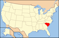
South Carolinas läge i USA | |
Winnsboro är administrativ huvudort i Fairfield County i den amerikanska delstaten South Carolina. Winnsboro grundades år 1785 och fick sitt namn efter Richard Winn som hade utmärkt sig i amerikanska frihetskriget.[1]
Källor
- ^ Winnsboro Historic District. South Carolina Department of Archives and History. Läst 3 maj 2014.
Media som används på denna webbplats
Shiny red button/marker widget. Used to mark the location of something such as a tourist attraction.
Fire Station & Municipal Offices, Congress & Washington Streets, Winnsboro, Fairfield County (South Carolina) - cropped
Författare/Upphovsman: This version: uploader
Base versions this one is derived from: originally created by en:User:Wapcaplet, Licens: CC BY 2.0
Map of USA with South Carolina highlighted
Författare/Upphovsman: Alexrk, Licens: CC BY 3.0
Den här Det karta skapades med GeoTools.


