Whiting, Indiana
| Whiting | |
| city | |
119th Street | |
| Land | |
|---|---|
| Delstat | Indiana |
| County | Lake County |
| Höjdläge | 179 m ö.h. |
| Koordinater | 41°40′47″N 87°29′40″V / 41.67972°N 87.49444°V |
| Yta | 8,4 km² (2010) |
| - land | 4,7 km² |
| - vatten | 3,7 km² |
| Folkmängd | 4 997 (2010) |
| Befolkningstäthet | 1 063 invånare/km² |
| Tidszon | CST (UTC-6) |
| - sommartid | CDT (UTC-5) |
| ZIP-kod | 46394 |
| Riktnummer | 219 |
| FIPS | 1884122 |
| Geonames | 4928208 |
Ortens läge i Indiana | |
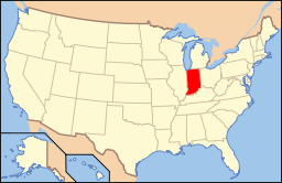
Indianas läge i USA | |
| Webbplats: https://www.whitingindiana.com/ | |
Whiting är en ort i Lake County i Indiana.[1] Vid 2010 års folkräkning hade Whiting 4 997 invånare.[2]
Kända personer från Whiting
- Ferid Murad, farmakolog
Källor
- ^ Whiting, IN. Map Quest. Läst 29 juli 2019.
- ^ 2010 Census Population of Whiting, Indiana Arkiverad 29 juli 2019 hämtat från the Wayback Machine.. Census Viewer. Läst 29 juli 2019.
|
Media som används på denna webbplats
Författare/Upphovsman: Alexrk2, Licens: CC BY 3.0
Den här Det karta skapades med GeoTools.
Shiny red button/marker widget. Used to mark the location of something such as a tourist attraction.
Författare/Upphovsman: This version: uploader
Base versions this one is derived from: originally created by en:User:Wapcaplet, Licens: CC BY 2.0
Map of USA with Indiana highlighted
Buildings on the northern side of the 1300 block of 119th Street in Whiting, Indiana, United States. This block is part of the Whiting Commercial Historic District. Most of the pictured buildings were built in 1925.


