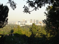
Westwood, Los Angeles
| Den här artikeln behöver källhänvisningar för att kunna verifieras. (2025-01) Åtgärda genom att lägga till pålitliga källor (gärna som fotnoter). Uppgifter utan källhänvisning kan ifrågasättas och tas bort utan att det behöver diskuteras på diskussionssidan. |
| Westwood, Los Angeles | |
| Land | |
|---|---|
| Delstat | |
| County | Los Angeles County |
| Stad | Los Angeles |
| Koordinater | 34°3′22″N 118°25′48″V / 34.05611°N 118.43000°V |
| Area | 9,53 km² |
| Tidszon | PST (UTC-8) |
| - sommartid | PDT (UTC-7) |
| Geonames | 5408522 |
(c) Open Street Map contributors, CC BY 2.0 Översiktskarta | |
Kaliforniens läge i USA | |
| Wikimedia Commons: Westwood, Los Angeles | |
| Redigera Wikidata | |

Westwood är en stadsdel i västra Los Angeles, Kalifornien, USA. Westwood omges av Bel Air i norr, Brentwood i väster och West Los Angeles i söder.
Westwood är mest känt för att ett av USA:s största och mest betydelsefulla universitet ligger där, University of California, Los Angeles (UCLA). UCLA upptar ett mycket vidsträckt område med forsknings- och utbildningsbyggnader, sportanläggningar och parker. Atmosfären i Westwood präglas av dess tusentals studenter. Söder om UCLA ligger många restauranger, caféer, barer och butiker och området kallas Westwood Village. Westwood genomkorsas av Wilshire Boulevard, Santa Monica Boulevard och Sunset Boulevard. Längs Wilshire Boulevard och Santa Monica Boulevard finns höga hus med mestadels kontor. Mellan Wilshire Boulevard och Santa Monica Boulevard ligger Westwood Village Memorial Park Cemetery där många filmstjärnor, bland andra Marilyn Monroe, ligger begravda.
Väster om UCLA hittar man Westwood Cemetery, en kyrkogård för stupade i krig.
Se även
- University of California, Los Angeles
- Westwood Village
Referenser
Externa länkar
 Wikimedia Commons har media som rör Westwood, Los Angeles.
Media som används på denna webbplats
Författare/Upphovsman: Tkgd2007, Licens: CC BY-SA 3.0
A new incarnation of Image:Question_book-3.svg, which was uploaded by user AzaToth. This file is available on the English version of Wikipedia under the filename en:Image:Question book-new.svg
Flag of California. This version is designed to accurately depict the standard print of the bear as well as adhere to the official flag code regarding the size, position and proportion of the bear, the colors of the flag, and the position and size of the star.
Författare/Upphovsman: Huebi, Licens: CC BY 2.0
Map of USA with California highlighted
(c) Jorobeq på engelska Wikipedia, CC BY 2.5
Westwood and Century City as seen from Bel Air
Författare/Upphovsman: Dicklyon, Licens: CC BY-SA 4.0
Late afternoon aerial photograph of Los Angeles's Westwood neighborhood (center), including the University of California, Los Angeles, and the Wilshire District of tall buildings along Wilshire Boulevard; the adjacent Century City neighborhood, far right; the eastern end of the Santa Monica Mountains, and beyond that the San Fernando Valley, in the background; Interstate 405 at the left.
(c) Open Street Map contributors, CC BY 2.0
Map of Westwood, California, as delineated by the Los Angeles Times
Boundary map as drawn by the Los Angeles Times on a CC-by-SA background. Note at bottom right of map on the L.A. Times website noted above says "CC-by-SA" (which gives permission to use the map). There is a link there to https://creativecommons.org/licenses/by-sa/2.0, which explains the meaning thereof. The base map is credited to http://www.openstreetmap.org/
The Times spells all this out at http://projects.latimes.com/mapping-la/about/#the-data


