Wellington (olika betydelser)
Wellington kan syfta på:
- Wellington – Nya Zeelands huvudstad
- Biff Wellington – en kötträtt
- Wellington (äpple) – en äppelsort
- Wellington Town FC – en fotbollsklubb från Wellington i Somerset i England
- Vickers Wellington – brittiskt bombplan (1936–1953)
Personer
- Wellington Koo (1887–1985), kinesisk diplomat
- Arthur Wellesley, 1:e hertig av Wellington (1769–1852), en brittisk militär, torypolitiker och diplomat
Se även
- Hertig av Wellington – flera
Geografi
Australien
- Wellington, South Australia, ort, Murray Bridge, 35°21′00″S 139°23′00″Ö / 35.35°S 139.38333°Ö
- Wellington, New South Wales, ort, Dubbo Region, New South Wales, 32°33′21″S 148°56′42″Ö / 32.55588°S 148.94508°Ö
- Wellington Council, tidigare local government area, 32°34′30″S 148°58′26″Ö / 32.57502°S 148.97395°Ö
- Wellington Shire, local government area, Victoria, 38°02′16″S 147°01′01″Ö / 38.03765°S 147.01697°Ö
Indien
- Wellington, Indien, ort i Tamil Nadu, 11°21′50″N 76°47′07″Ö / 11.36389°N 76.78525°Ö
Kanada
- Wellington, Kanada, Prince Edward Island, 46°27′01″N 63°59′55″V / 46.45014°N 63.99874°V
Se även
- Wellington County, county i Ontario
- Wellington Bay, vik i Nunavut
Nya Zeeland
- Wellington, huvudstaden, 41°17′12″S 174°46′32″Ö / 41.28664°S 174.77557°Ö
- Wellington City, kommun
- Wellington (region), region
- Wellington (provins), tidigare provins (1853–1876)
Storbritannien
- Wellington, Shropshire, ort i England, 52°42′00″N 2°31′00″V / 52.7°N 2.51667°V
- Wellington, Herefordshire, ort i England, 52°08′22″N 2°44′13″V / 52.13939°N 2.73697°V
- Wellington, Somerset, stad i England, 50°58′42″N 3°14′16″V / 50.97839°N 3.23777°V
Se även
- Wellington Without – en civil parish i grevskapet Somerset
- Wellington Heath – en ort i grevskapet Herefordshire
Sydafrika
- Wellington, Sydafrika, stad i Västra Kapprovinsen, 33°39′04″S 19°00′04″Ö / 33.6511°S 19.0011°Ö
USA
- Wellington, Florida, ort, Palm Beach County, 26°39′31″N 80°14′29″V / 26.65868°N 80.24144°V
- Wellington, Kansas, countyhuvudort, Sumner County, 37°15′55″N 97°22′18″V / 37.2653°N 97.37171°V
- Wellington, Kentucky, ort, Jefferson County, 38°12′59″N 85°40′09″V / 38.21646°N 85.66913°V
- Wellington, Missouri, Lafayette County, 39°08′03″N 93°58′58″V / 39.13418°N 93.98272°V
- Wellington, Illinois, Iroquois County, 40°32′21″N 87°40′48″V / 40.5392°N 87.68003°V
- Wellington, Maine, Piscataquis County, 45°02′23″N 69°35′50″V / 45.03978°N 69.59727°V
- Wellington, Ohio, Lorain County, 41°10′08″N 82°13′05″V / 41.16894°N 82.21794°V
- Wellington, Texas, countyhuvudort, Collingsworth County, 34°51′22″N 100°12′49″V / 34.85617°N 100.21373°V
- Wellington, Utah, Carbon County, 39°32′33″N 110°44′08″V / 39.54247°N 110.73543°V
- Wellington, Colorado, ort, Larimer County, 40°42′14″N 105°00′31″V / 40.70387°N 105.00859°V
Media som används på denna webbplats
Författare/Upphovsman: NordNordWest, Licens: CC BY-SA 3.0
Location map of Australia
Shiny blue button/marker widget.
(c) Uwe Dedering på tyska Wikipedia, CC BY-SA 3.0
Location map of India.
Equirectangular projection. Strechted by 106.0%. Geographic limits of the map:
- N: 37.5° N
- S: 5.0° N
- W: 67.0° E
- E: 99.0° E
(c) Karte: NordNordWest, Lizenz: Creative Commons by-sa-3.0 de
Location map of the United Kingdom
Författare/Upphovsman: NordNordWest, Licens: CC BY 3.0
Location map of South Africa
Författare/Upphovsman: TUBS
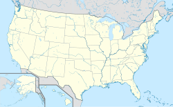
Location map of the USA (Hawaii and Alaska shown in sidemaps).
Main map: EquiDistantConicProjection : Central parallel :
* N: 37.0° N
Central meridian :
* E: 96.0° W
Standard parallels:
* 1: 32.0° N
* 2: 42.0° N
Made with Natural Earth. Free vector and raster map data @ naturalearthdata.com.
Formulas for x and y:
x = 50.0 + 124.03149777329222 * ((1.9694462586094064-({{{2}}}* pi / 180))
      * sin(0.6010514667026994 * ({{{3}}} + 96) * pi / 180))
y = 50.0 + 1.6155950752393982 * 124.03149777329222 * 0.02613325650382181
      - 1.6155950752393982  * 124.03149777329222 *
     (1.3236744353715044  - (1.9694462586094064-({{{2}}}* pi / 180))
      * cos(0.6010514667026994 * ({{{3}}} + 96) * pi / 180))
Hawaii side map: Equirectangular projection, N/S stretching 107 %. Geographic limits of the map:
- N: 22.4° N
- S: 18.7° N
- W: 160.7° W
- E: 154.6° W
Alaska side map: Equirectangular projection, N/S stretching 210.0 %. Geographic limits of the map:
- N: 72.0° N
- S: 51.0° N
- W: 172.0° E
- E: 129.0° W
Logo for disambiguation pages.
Författare/Upphovsman: NordNordWest, Licens: CC BY-SA 3.0
Plats karta över Nya Zeeland
Författare/Upphovsman: Yug, Licens: CC BY-SA 3.0
cropped version of Carte administrative du Canada.svg for map location.

