Wellfleet
| Wellfleet | ||
| Kommun (town) | ||
| Land | ||
|---|---|---|
| Delstat | ||
| County | Barnstable County | |
| Höjdläge | 15 m ö.h. | |
| Koordinater | 41°55′50″N 70°1′52″V / 41.93056°N 70.03111°V | |
| Area | 91,7 km² | |
| Folkmängd | 3 566 (2020)[2] | |
| Befolkningstäthet | 39 invånare/km² | |
| Grundad | 1763[1] | |
| Tidszon | EST (UTC-5) | |
| - sommartid | EDT (UTC-4) | |
| GNIS-kod | 618261 | |
| Geonames | 4954763 | |
Översiktskarta | ||
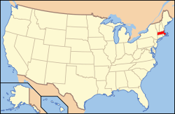
Massachusetts läge i USA | ||
| Wikimedia Commons: Wellfleet, Massachusetts | ||
| Redigera Wikidata | ||

Wellfleet är en kommun (town) i Barnstable County i delstaten Massachusetts, USA med cirka 2 749 invånare (2000). Den har enligt United States Census Bureau en area på 91,6 km² varav 40,2 km² är vatten.
Referenser
- ^ hämtat från: engelskspråkiga Wikipedia.[källa från Wikidata]
- ^ United States Census Bureau (red.), USA:s folkräkning 2020, läs online, läst: 1 januari 2022.[källa från Wikidata]
| ||||||||||
Media som används på denna webbplats
Författare/Upphovsman: Rcsprinter123, Licens: CC BY 3.0
Map showing the location of this town within Barnstable County, Massachusetts. Data source: 2010 U.S. census
(c) ToddC4176 at the English Wikipedia, CC BY-SA 3.0
Wellfleet Town Hall, Wellfleet, Massachusetts
Författare/Upphovsman:
 |
This image or media was taken or created by Matt H. Wade. To see his entire portfolio, click here. @thatmattwade
|
Sandy pathway to a town beach in Wellfleet, Massachusetts on Cape Cod
Författare/Upphovsman: This version: uploader
Base versions this one is derived from: originally created by en:User:Wapcaplet, Licens: CC BY 2.0
Map of USA with Massachusetts highlighted
Seal of Wellfleet, Massachusetts, adopted in 1898.


