Watertown, Connecticut
| Watertown | |
| Land | |
|---|---|
| Delstat | |
| County | Naugatuck Valley Planning Region |
| Höjdläge | 189 m ö.h. |
| Koordinater | 41°37′0″N 73°7′0″V / 41.61667°N 73.11667°V |
| Area | 76,66 km² |
| Folkmängd | 22 105 (2020)[2] |
| Befolkningstäthet | 288 invånare/km² |
| Grundad | 1780[1] |
| Tidszon | EST (UTC-5) |
| - sommartid | EDT (UTC-4) |
| Riktnummer | 860 |
| GNIS-kod | 213527 |
| Geonames | 4845245 |
Översiktskarta | |
| Wikimedia Commons: Watertown, Connecticut | |
| Webbplats: http://www.watertownct.org/ | |
| Redigera Wikidata | |
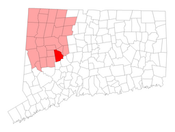
Watertown är en kommun (town) i Litchfield County i delstaten Connecticut, USA med cirka 22 100 invånare (2002). Den har enligt United States Census Bureau en area på totalt 76, km² varav 1,1 km² är vatten.
Referenser
- ^ hämtat från: engelskspråkiga Wikipedia.[källa från Wikidata]
- ^ United States Census Bureau (red.), USA:s folkräkning 2020, läs online, läst: 1 januari 2022.[källa från Wikidata]
| ||||||||||
Media som används på denna webbplats
Författare/Upphovsman: Jerry Dougherty, Licens: CC BY 2.5
Munson Memorial Park, Watertown, Connecticut
|
This is an image of a place or building that is listed on the National Register of Historic Places in the United States of America. Its reference number is 1000352. |


