Wasco County
| Wasco County | |
| County | |
Wasco Countys domstolshus i The Dalles. | |
| Land | |
|---|---|
| Delstat | |
| Huvudort | The Dalles |
| Area | 6 204 km² (2010)[1] |
| - land | 6 168 km² (99%) |
| - vatten | 35,9 km² (1%) |
| Folkmängd | 25 213 (2010)[2] |
| Befolkningstäthet | 4,1 invånare/km² |
| Grundat | 1854 |
| Tidszon | PST (UTC-8) |
| - sommartid | PDT (UTC-7) |
| FIPS-kod | 41065 |
| Geonames | 5759298 |
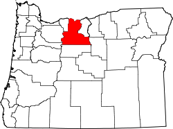
 Läge i delstaten Oregon. | |
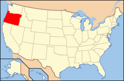
Delstatens läge i USA. | |
Wasco County är ett administrativt område i delstaten Oregon, USA. År 2010 hade countyt 25 213 invånare. Den administrativa huvudorten (county seat) är The Dalles.
Geografi
Enligt United States Census Bureau så har countyt en total area på 6 203 km². 6 167 km² av den arean är land och 36 km² är vatten.
Angränsande countyn
- Hood River County, Oregon - väst
- Clackamas County, Oregon - väst
- Marion County, Oregon - sydväst
- Jefferson County, Oregon - syd
- Wheeler County, Oregon - sydöst
- Gilliam County, Oregon - öst
- Sherman County, Oregon - öst
- Klickitat County, Washington - nord
Källor
- ^ ”2010 Census U.S. Gazetteer Files for Counties”. U.S. Census Bureau. Arkiverad från originalet den 5 juli 2012. https://www.webcitation.org/68vYLbou5?url=http://www.census.gov/geo/www/gazetteer/files/Gaz_counties_national.txt. Läst 5 juli 2012.
- ^ ”State & County QuickFacts, Wasco County, Oregon” (på engelska). U.S. Census Bureau. Arkiverad från originalet den 22 juli 2011. https://www.webcitation.org/60MlxSIzy?url=http://quickfacts.census.gov/qfd/states/41/41065.html. Läst 6 juli 2011.
| ||||||||||
Media som används på denna webbplats
Flag of Oregon (obverse): The flag was adopted by the state on February 26, 1925.[1] The state seal was decided in 1903.[2][3]
Författare/Upphovsman: Huebi, Licens: CC BY 2.0
Map of United States with Oregon highlighted.
This is a locator map showing Wasco County in Oregon. For more information, see Commons:United States county locator maps.
Författare/Upphovsman: Cacophony, Licens: CC BY 3.0
Wasco County Courthouse in The Dalles, Oregon.


