Vollrathsruhe
| Vollrathsruhe | |
| Kommun | |
Slottet Vollrathsruhe. | |
| Land | |
|---|---|
| Förbundsland | Mecklenburg-Vorpommern |
| Kreis | Landkreis Mecklenburgische Seenplatte |
| Förvaltningsgemenskap | Amt Seenlandschaft Waren |
| Höjdläge | 70 m ö.h. |
| Koordinater | 53°38′37″N 12°29′17″Ö / 53.64362°N 12.48819°Ö |
| Yta | 31,36 km² ()[1] |
| Folkmängd | 421 ()[2] |
| Befolkningstäthet | 13 inv./km² |
| Postnummer | 17194 |
| Riktnummer | (+49) 039933 |
| Kommunkod | 13 0 71 154 |
| Geonames | 6548100 |
| OSM-karta | 1424295 |
Läget för Vollrathsruhe i Tyskland | |
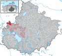
Läget för kommunen Vollrathsruhe i Landkreis Mecklenburgische Seenplatte | |
| Webbplats: Vollrathsruhe | |
Vollrathsruhe är en kommun och ort i Landkreis Mecklenburgische Seenplatte i förbundslandet Mecklenburg-Vorpommern i Tyskland.
Kommunen ingår i kommunalförbundet Amt Seenlandschaft Waren tillsammans med kommunerna Grabowhöfe, Groß Plasten, Hohen Wangelin, Jabel, Kargow, Klink, Klocksin, Moltzow, Peenehagen, Schloen-Dratow och Torgelow am See.[3]
Referenser
- ^ Alle politisch selbständigen Gemeinden mit ausgewählten Merkmalen am 31.12.2018 (4. Quartal) (på tyska), Statistisches Bundesamt, läs online, läst: 10 mars 2019.[källa från Wikidata]
- ^ Alle politisch selbständigen Gemeinden mit ausgewählten Merkmalen am 31.12.2022, Statistisches Bundesamt, 21 september 2023, läs online, läst: 7 oktober 2023.[källa från Wikidata]
- ^ ”Alle politisch selbständigen Gemeinden mit ausgewählten Merkmalen am 31.03.2020” (Excel). Statistisches Bundesamt. 2020. https://www.destatis.de/DE/Themen/Laender-Regionen/Regionales/Gemeindeverzeichnis/Administrativ/Archiv/GVAuszugQ/AuszugGV1QAktuell.xlsx?__blob=publicationFile. Läst 8 juli 2020.
|
Media som används på denna webbplats
Författare/Upphovsman: TUBS
Location map of Germany with waterbodies
Shiny red button/marker widget. Used to mark the location of something such as a tourist attraction.
|
|
|
|
|
|
|
|
Författare/Upphovsman: Doris Antony, Berlin, Licens: CC BY-SA 4.0
Manor house in Vollrathsruhe, Mecklenburg, Germany


