Vale of White Horse District
| Vale of White Horse District | |
| Distrikt | |
| Land | |
|---|---|
| Riksdel | England |
| Region | Sydöstra England |
| Ceremoniellt grevskap | Oxfordshire |
| Administrativt grevskap | Oxfordshire |
| Koordinater | 51°40′N 1°25′V / 51.67°N 1.42°V |
| Administrativ huvudort | Milton |
| Area | 578 km²[1] |
| Folkmängd | 142 116 (2022)[2] |
| Befolkningstäthet | 246 invånare/km² |
| Tidszon | UTC (UTC+0) |
| - sommartid | BST (UTC+1) |
| GSS-kod | E07000180 |
| Geonames | 2635027 |
Contains Ordnance Survey data © Crown copyright and database right, CC BY-SA 3.0 Läge i Oxfordshire | |
Vale of White Horse är ett distrikt (motsvarande kommun) i grevskapet Oxfordshire i England, Storbritannien. Distriktet har 142 116 invånare (2022)[2]. Större orter är Abingdon-on-Thames och Wantage. Distriktet är indelat i 70 civil parishes.
Källor
- ^ ”Estimates of the population for the UK, England, Wales, Scotland, and Northern Ireland (Mid-2022)” (på engelska) (xls). Landyta, avrundad till hela km². Office for National Statistics. 26 mars 2024. https://www.ons.gov.uk/peoplepopulationandcommunity/populationandmigration/populationestimates/datasets/populationestimatesforukenglandandwalesscotlandandnorthernireland. Läst 25 juni 2024.
- ^ [a b] ”Estimates of the population for the UK, England, Wales, Scotland, and Northern Ireland (Mid-2022)” (på engelska) (xls). Office for National Statistics. 26 mars 2024. https://www.ons.gov.uk/peoplepopulationandcommunity/populationandmigration/populationestimates/datasets/populationestimatesforukenglandandwalesscotlandandnorthernireland. Läst 25 juni 2024.
Externa länkar
 Wikimedia Commons har media som rör Vale of White Horse.
Media som används på denna webbplats
Contains Ordnance Survey data © Crown copyright and database right, CC BY-SA 3.0
Map of Oxfordshire, UK with Vale of White Horse highlighted.
Equirectangular map projection on WGS 84 datum, with N/S stretched 160%Författare/Upphovsman: Motacilla, Licens: CC BY-SA 4.0
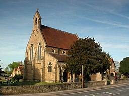
Roman Catholic church of Our Lady and St Edmund, Abingdon, Oxfordshire (formerly Berkshire), seen from the southwest. Designed by William Wardell and George Goldie and built in 1857–65.


