Union, Washington
| Union | |
| CDP | |
| Land | |
|---|---|
| Delstat | |
| County | Mason County |
| Höjdläge | 45 m ö.h. |
| Koordinater | 47°21′25″N 123°6′0″V / 47.35694°N 123.10000°V |
| Area | 4,19 km² (2010)[1] |
| Folkmängd | 683 (2020)[2] |
| Befolkningstäthet | 163 invånare/km² |
| Tidszon | PST (UTC-8) |
| - sommartid | PDT (UTC-7) |
| ZIP-kod | 98592 |
| Riktnummer | 360 |
| GNIS-kod | 1527608 |
| Geonames | 5814406 |
Ortens läge i delstaten | |
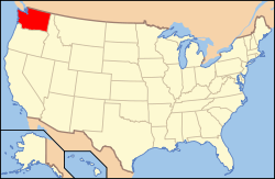
Washingtons läge i USA | |
| Wikimedia Commons: Union, Washington | |
| Redigera Wikidata | |
Union är en så kallad census-designated place i Mason County i delstaten Washington.[3] Vid 2010 års folkräkning hade Union 631 invånare.[4]
Källor
- ^ United States Census Bureau, 2010 U.S. Gazetteer Files, United States Census Bureau, 2010, läst: 9 juli 2020.[källa från Wikidata]
- ^ United States Census Bureau (red.), USA:s folkräkning 2020, läs online, läst: 1 januari 2022.[källa från Wikidata]
- ^ Union, WA. Map Quest. Läst 24 juli 2021.
- ^ 2010 Census Population of Union, Washington Arkiverad 24 juli 2021 hämtat från the Wayback Machine.. Census Viewer. Läst 24 juli 2021.
Media som används på denna webbplats
Shiny red button/marker widget. Used to mark the location of something such as a tourist attraction.
Författare/Upphovsman: Luv2balive, Licens: CC BY-SA 3.0
Beautiful Winter day at home
Författare/Upphovsman: Alexrk2, Licens: CC BY 3.0
Den här Det karta skapades med GeoTools.
Författare/Upphovsman: This version: uploader
Base versions this one is derived from: originally created by en:User:Wapcaplet, Licens: CC BY 2.0
Map of USA with Washington highlighted


