Union
Union kan syfta på:
Politiska samarbeten
- Unionsparteien, die Union – det tyska partisamarbetet, se CDU/CSU
Religion
- Union (protestantism) – föreningen mellan reformerta och lutherska kyrkor
Sport
- 1. FC Union Berlin – tysk fotbollsklubb
- BK Union – fotbollsklubb i Kyrkhult
Statsvetenskap och statsunioner
- Union (statsvetenskap) – i statsvetenskapliga sammanhang om sammanslutningar mellan flera stater eller delstater
- Personalunion – en union mellan två eller flera stater med gemensam statschef
- Realunion – de ingående delarna har överlämnat större eller mindre maktbefogenheter till unionen
- Union Jack – flaggan för unionen Storbritannien
- Unionstiden – avser vanligtvis perioden 1389–1523, då Sverige tillsammans med Danmark och Norge ingick i Kalmarunionen
- Unionstiden – även perioden 1814–1905, då Sverige och Norge var i personalunion, se Svensk-norska unionen
Teknik/naturvetenskap
- Union (matematik) – i mängdläran sammanslagning av mängder
- Union (rörledning) – ett kopplingselement för delbar sammanfogning av rör, se vattenledning
Geografi
Antarktis
Argentina
- Departamento de Unión, kommun, Córdoba, 32°50′00″S 62°45′00″V / 32.83333°S 62.75°V
- Unión, Argentina, San Luis, 35°09′10″S 65°56′46″V / 35.15282°S 65.94602°V
Spanien
- Unión (kommun), Murcia, Murcia, 37°36′13″N 0°52′24″V / 37.60355°N 0.87329°V
USA
- Union, Alabama, ort, Greene County, 32°59′17″N 87°54′54″V / 32.98818°N 87.91502°V
- Union, Kentucky, ort, Boone County, 38°56′45″N 84°40′50″V / 38.9459°N 84.6805°V
- Union, Louisiana, ort, Saint James Parish, 30°05′14″N 90°54′17″V / 30.08714°N 90.90482°V
- Union, Missouri, countyhuvudort, Franklin County, 38°27′00″N 91°00′31″V / 38.45005°N 91.00848°V
- Union, Mississippi, ort, Newton County, 32°34′18″N 89°07′17″V / 32.57153°N 89.12145°V
- Union, Ohio, ort, Montgomery County, 39°53′52″N 84°18′23″V / 39.89783°N 84.30633°V
- Union, South Carolina, countyhuvudort, Union County, 34°42′55″N 81°37′25″V / 34.71541°N 81.62371°V
- Union, West Virginia, countyhuvudort, Monroe County, 37°35′29″N 80°32′37″V / 37.59151°N 80.54368°V
- Union, Maine, ort, Knox County, 44°12′41″N 69°16′27″V / 44.21147°N 69.27421°V
- Union, Iowa, ort, Hardin County, 42°14′44″N 93°03′53″V / 42.24554°N 93.06465°V
- Union, Illinois, ort, McHenry County, 42°13′59″N 88°32′32″V / 42.23308°N 88.54231°V
- Union, Nebraska, ort, Cass County, 40°48′48″N 95°55′22″V / 40.81333°N 95.92278°V
- Union, New Hampshire, ort, Carroll County, 43°29′29″N 71°01′23″V / 43.49147°N 71.02312°V
- Union, New Jersey, ort, Union County, 40°41′51″N 74°15′48″V / 40.6976°N 74.2632°V
- Union, Oregon, ort, Union County, 45°12′30″N 117°51′55″V / 45.20847°N 117.86521°V
- Union, Washington, ort, Mason County, 47°21′18″N 123°06′04″V / 47.35509°N 123.10099°V
- Union, Connecticut – en ort
Se även
- Union County – flera
- Union City – flera
- La Unión – flera
- Villa Unión – flera
Se även
- Union Station – flera
- Unionen (olika betydelser)
- Unionism – politisk rörelse för delaktighet i visst statsförbund, t.ex. Storbritannien
- Unionoida – en ordning i klassen musslor
Media som används på denna webbplats
Shiny blue button/marker widget.
Författare/Upphovsman: NordNordWest, Licens: CC BY-SA 3.0
Location map of Spain
Equirectangular projection, N/S stretching 130 %. Geographic limits of the map:
- N: 44.4° N
- S: 34.7° N
- W: 9.9° W
- E: 4.8° E
Författare/Upphovsman: TUBS
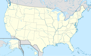
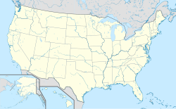
Location map of the USA (Hawaii and Alaska shown in sidemaps).
Main map: EquiDistantConicProjection : Central parallel :
* N: 37.0° N
Central meridian :
* E: 96.0° W
Standard parallels:
* 1: 32.0° N
* 2: 42.0° N
Made with Natural Earth. Free vector and raster map data @ naturalearthdata.com.
Formulas for x and y:
x = 50.0 + 124.03149777329222 * ((1.9694462586094064-({{{2}}}* pi / 180))
      * sin(0.6010514667026994 * ({{{3}}} + 96) * pi / 180))
y = 50.0 + 1.6155950752393982 * 124.03149777329222 * 0.02613325650382181
      - 1.6155950752393982  * 124.03149777329222 *
     (1.3236744353715044  - (1.9694462586094064-({{{2}}}* pi / 180))
      * cos(0.6010514667026994 * ({{{3}}} + 96) * pi / 180))
Hawaii side map: Equirectangular projection, N/S stretching 107 %. Geographic limits of the map:
- N: 22.4° N
- S: 18.7° N
- W: 160.7° W
- E: 154.6° W
Alaska side map: Equirectangular projection, N/S stretching 210.0 %. Geographic limits of the map:
- N: 72.0° N
- S: 51.0° N
- W: 172.0° E
- E: 129.0° W
Logo for disambiguation pages.
Författare/Upphovsman: Alexrk2, Licens: CC BY-SA 3.0
Location map Antarctica, Azimuthal equidistant projection
Författare/Upphovsman: NordNordWest, Licens: CC BY-SA 3.0
Location map of Argentina


