Turnov
| Turnov | |||
| Turnau | |||
| Stad | |||
| |||
| Land | |||
|---|---|---|---|
| Region | Liberec | ||
| Distrikt | Semily | ||
| Höjdläge | 260 m ö.h. | ||
| Koordinater | 50°35′14″N 15°9′25″Ö / 50.58722°N 15.15694°Ö | ||
| Area | 22,73 km² | ||
| Folkmängd | 14 349 (1 januari 2016)[1] | ||
| Befolkningstäthet | 631 invånare/km² | ||
| Tidszon | CET (UTC+1) | ||
| - sommartid | CEST (UTC+2) | ||
| Postnummer | 511 01 | ||
| Geonames | 3063853 | ||
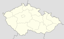
Läge i Tjeckien | |||
Turnov (tyska: Turnau) är en stad i norra Tjeckien. Per den 1 januari 2016 hade staden 14 349 invånare.[1]
Backhopparen Roman Koudelka är född i Turnov men bor numera i Liberec.
Referenser
Externa länkar
 Wikimedia Commons har media som rör Turnov.
- Officiell webbplats
Media som används på denna webbplats
Shiny red button/marker widget. Used to mark the location of something such as a tourist attraction.
Författare/Upphovsman:
| This image is a work by Miloslav Rejha (User:M.Rejha). When reusing, please credit me as: Miloslav Rejha, Wikimedia Commons.
I would appreciate being notified if you use my work outside Wikimedia. Do not copy this image illegally by ignoring the terms of the license below, as it is not in the public domain. If you would like special permission to use, license, or purchase the image please contact me. More of my work can be found in my photostream on Flickr. |
Český ráj (Bohemian Paradise) Square, Turnov, Czechia
Författare/Upphovsman: Lencer, Licens: CC BY-SA 3.0
Location map of the Czech Republic


