Turkana (distrikt)
- För andra betydelser, se Turkana.
| Den här artikeln behöver källhänvisningar för att kunna verifieras. (2023-02) Åtgärda genom att lägga till pålitliga källor (gärna som fotnoter). Uppgifter utan källhänvisning kan ifrågasättas och tas bort utan att det behöver diskuteras på diskussionssidan. |
| Turkana | |
| Distrikt | |
| Land | |
|---|---|
| Koordinater | 3°09′N 36°00′Ö / 3.15°N 36.00°Ö |
| Tidszon | EAT (UTC+3) |
| Geonames | 178914 |
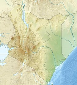
Läge i Kenya | |
Turkana är ett av Kenyas 71 administrativa distrikt, och ligger i provinsen Rift Valley. År 1999 hade distriktet 450 860 invånare. Huvudorten är Lodwar.
| |||||
Media som används på denna webbplats
Författare/Upphovsman: Tkgd2007, Licens: CC BY-SA 3.0
A new incarnation of Image:Question_book-3.svg, which was uploaded by user AzaToth. This file is available on the English version of Wikipedia under the filename en:Image:Question book-new.svg
Författare/Upphovsman: Uwe Dedering, Licens: CC BY-SA 3.0
Location map of Kenya
Equirectangular projection. Strechted by 100.0%. Geographic limits of the map:
- N: 6.0° N
- S: -5.0° N
- W: 33.0° E
- E: 43.0° E
Shiny red button/marker widget. Used to mark the location of something such as a tourist attraction.


