Tujetsch
| Tujetsch | ||
| rätoromanska: Vischnuanca Tujetsch | ||
| Kommun | ||
Oberalppass på Tujetsch-sidan | ||
| ||
| Land | ||
|---|---|---|
| Kanton | ||
| Region | Surselva | |
| Höjdläge | 1 406 m ö.h. | |
| Koordinater | 46°40′54″N 8°46′41″Ö / 46.68167°N 8.77806°Ö | |
| Huvudort | Sedrun | |
| Högsta punkt | ||
| - läge | Oberalpstock | |
| - höjdläge | 3 327 m ö.h. | |
| Lägsta punkt | ||
| - läge | Vorderrhein | |
| - höjdläge | 1 230 m ö.h. | |
| Yta | 133,91 km²[1] | |
| Folkmängd | 1 197 (2021-12-31)[2] | |
| Befolkningstäthet | 9 inv./km² | |
| Tidszon | CET (UTC+1) | |
| - sommartid | CEST (UTC+2) | |
| Postnummer | 7187 Camischolas 7188 Sedrun 7189 Rueras | |
| Kommunkod | 3986 | |
| Geonames | 7287351 | |
| Språk | rätoromanska | |
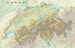
Tujetschs läge i Schweiz | ||
Detaljkarta kommunindelning | ||
| Webbplats: http://www.tujetsch.ch | ||
Tujetsch (föråldrad tysk namnform Tavetsch) är en kommun i regionen Surselva i kantonen Graubünden, Schweiz. Kommunen har 1 197 invånare (2021).[2]
Kommunen består av centralorten Sedrun och fraktionerna Tschamut, Selva, Dieni, Rueras, Zarcuns, Camischolas, Gionda, Bugnei, Surrein och Cavorgia. I väster går såväl väg som järnväg över Oberalppass (2044 m ö.h.) till kantonen Uri.
Källor
- ^ ”Arealstatistik Standard - Gemeinden nach 4 Hauptbereichen” (på tyska/franska). Bundesamt für Statistik. 25 november 2021. https://dam-api.bfs.admin.ch/hub/api/dam/assets/19805706/master.
- ^ [a b] ”Bilanz der ständigen Wohnbevölkerung nach Bezirken und Gemeinden, 1991-2021” (på tyska/franska/italienska). Bundesamt für Statistik. 25 augusti 2022. https://dam-api.bfs.admin.ch/hub/api/dam/assets/23064893/master.
| |||||||||
Media som används på denna webbplats
Författare/Upphovsman: Eric Gaba (Sting - fr:Sting) and NordNordWest, Licens: CC BY-SA 3.0
Blank physical map of Switzerland, for geo-location purpose. More maps: → Maps of Switzerland.
Shiny red button/marker widget. Used to mark the location of something such as a tourist attraction.
Författare/Upphovsman: upload by Adrian Michael, Licens: CC BY-SA 3.0
Oberalppass, eastern rise showing road serpentines and railway line above the road
Författare/Upphovsman: Tschubby, Licens: CC BY-SA 3.0
Municipality Tujetsch
Coat of Arms of Switzerland.
The "triangular" shield shape was frequently used by the federal administration throughout the 20th century, and adopted officially (as emblem of the federal administration, not necessarily as emblem of Switzerland as sovereign entity) in 2017. Precedents for this shield shape go back to designs dated to as early as 1815.
The official coat of arms of the Swiss Confederation is a white couped cross in a red heraldic shield, without explicit specification of the shape of the shield, and a variety of shield shapes are in use.


