Trinity, Texas
| Trinity, Texas | |
| Land | |
|---|---|
| Delstat | Texas |
| Läge | 30°56′44″N 95°22′32″V / 30.94556°N 95.37556°V |
| Yta | |
| - total: | 9,8 km² |
| - varav land: | 9,8 km² |
| - varav vatten: | 0,0 km² |
| Folkmängd | 2 721 (2000) |
| Geonames | 4737506 |
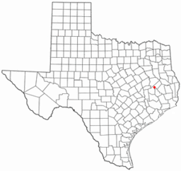
Trinitys läge i Texas. | |
Trinity är en stad i Trinity County i den amerikanska delstaten Texas med en yta av 9,8 km² och en folkmängd som uppgår till 2 721 invånare (2000). Trinity var administrativ huvudort i Trinity County 1873–1874 och fick stadsrättigheter år 1910. Orten hette först Trinity Station, sedan Trinity City, varefter namnet förkortades till Trinity.
Kända personer från Trinity
- Charles Nesbitt Wilson, politiker
Externa länkar
Media som används på denna webbplats
Författare/Upphovsman: The original uploader was Seth Ilys på engelska Wikipedia., Licens: CC BY-SA 3.0
Adapted from Wikipedia's TX county maps by Seth Ilys.
Författare/Upphovsman: Steven L. Driskell (SDriskell), Licens: CC BY-SA 3.0
Old Red Schoolhouse. Trinity's first schoolhouse was a one-room log structure built in 1872 near Cedar Grove Cemetery. A two-story frame schoolhouse that stood on this site from 1897 to 1911 was moved several blocks northwest to serve African American students. Under Supt. J. Woolam Bright, construction of a new brick building began here in 1911, and after many delays it opened by 1915. The Prairie Style, T-Plan building housed all grade levels until completion of an adjacent High School in 1928. "Old Red" served as a schoolhouse for 80 years. When it was slated for demolition in the 1990s, concerned citizens and former students worked with the School District to preserve the historic building for continued use. Recorded Texas Historic Landmark - 2004. Listed in the National Register of Historic Places by the United States Department of the Interior.


