Trinidad (olika betydelser)
Trinidad kan avse:
- Trinidad (spanskt fartyg) – ett av Ferdinand Magellans fartyg under den första världsomseglingen
- Trinidad (cigarrmärke) – två olika cigarrmärken
Geografi
Argentina
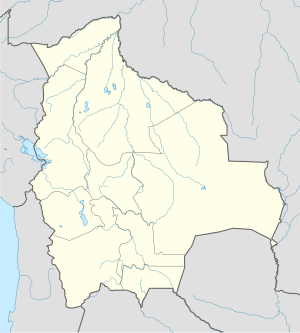
Bolivia
- Trinidad, Bolivia, departementshuvudort, Beni, 14°50′00″S 64°54′00″V / 14.83333°S 64.9°V
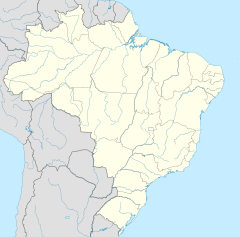
Brasilien
- Ilha da Trindade (ö i Brasilien, Espírito Santo), 20°31′30″S 29°19′30″V / 20.525°S 29.325°V
Colombia
- Trinidad (kommun i Colombia, Casanare, lat 5,35, long -71,20), 5°20′52″N 71°12′07″V / 5.34778°N 71.20194°V
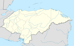
Honduras
- Trinidad de Copán (ort), Departamento de Copán, 14°57′N 88°45′V / 14.95°N 88.75°V
- Trinidad (kommun i Honduras, Departamento de Santa Bárbara, lat 15,14, long -88,27), 15°08′N 88°16′V / 15.14°N 88.27°V
- La Trinidad (ort i Honduras, Departamento de Yoro), 15°06′N 87°12′V / 15.1°N 87.2°V
- La Trinidad (ort i Honduras, Departamento de Comayagua, lat 14,72, long -87,67), 14°43′00″N 87°40′00″V / 14.71667°N 87.66667°V
Kuba
- Trinidad, Kuba, ort, Provincia de Sancti Spíritus, 21°48′07″N 79°59′03″V / 21.80194°N 79.98417°V
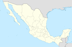
Mexiko
- Trinidad Zaachila (kommunhuvudort), Oaxaca, 16°55′17″N 96°45′50″V / 16.92135°N 96.76384°V
- La Trinidad, Santiago Yaveo, 17°26′22″N 95°32′56″V / 17.43958°N 95.54891°V
- La Trinidad, Coicoyán de las Flores, 17°18′34″N 98°15′38″V / 17.30952°N 98.26069°V
- Trinidad, Chiapas, Unión Juárez, 15°02′16″N 92°07′04″V / 15.03778°N 92.11778°V
Trinidad och Tobago
- Trinidad och Tobago, självständig stat
- Trinidad, ö, 10°27′40″N 61°15′25″V / 10.46114°N 61.25702°V
USA
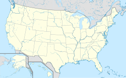
- Trinidad, Texas, Henderson County, 32°08′39″N 96°05′28″V / 32.14404°N 96.09108°V
- Trinidad, Colorado, countyhuvudort, Las Animas County, 37°10′10″N 104°30′02″V / 37.16946°N 104.50054°V
- Trinidad, Kalifornien, Humboldt County, 41°03′33″N 124°08′35″V / 41.05929°N 124.14312°V
Se även
- Trinidad Island
- Isla Trinidad
Media som används på denna webbplats
Författare/Upphovsman: NordNordWest, Licens: CC BY-SA 3.0
Location map of Argentina
Shiny blue button/marker widget.
Författare/Upphovsman: Sémhur, Licens: CC BY-SA 4.0
Map of Mexico, with states borders.
Logo for disambiguation pages.
Författare/Upphovsman: NordNordWest, Licens: CC BY-SA 3.0
Location map of Cuba
Författare/Upphovsman: Addicted04, Licens: CC BY-SA 3.0
Location map of Honduras.
Geographic limits of the map:
* West : 269.50 W
* East : 89.00W
* North : 24.00N
* South : 180.00N
Författare/Upphovsman: TUBS
Location map of the USA (Hawaii and Alaska shown in sidemaps).
Main map: EquiDistantConicProjection : Central parallel :
* N: 37.0° N
Central meridian :
* E: 96.0° W
Standard parallels:
* 1: 32.0° N
* 2: 42.0° N
Made with Natural Earth. Free vector and raster map data @ naturalearthdata.com.
Formulas for x and y:
x = 50.0 + 124.03149777329222 * ((1.9694462586094064-({{{2}}}* pi / 180))
      * sin(0.6010514667026994 * ({{{3}}} + 96) * pi / 180))
y = 50.0 + 1.6155950752393982 * 124.03149777329222 * 0.02613325650382181
      - 1.6155950752393982  * 124.03149777329222 *
     (1.3236744353715044  - (1.9694462586094064-({{{2}}}* pi / 180))
      * cos(0.6010514667026994 * ({{{3}}} + 96) * pi / 180))
Hawaii side map: Equirectangular projection, N/S stretching 107 %. Geographic limits of the map:
- N: 22.4° N
- S: 18.7° N
- W: 160.7° W
- E: 154.6° W
Alaska side map: Equirectangular projection, N/S stretching 210.0 %. Geographic limits of the map:
- N: 72.0° N
- S: 51.0° N
- W: 172.0° E
- E: 129.0° W
Författare/Upphovsman: NordNordWest, Licens: CC BY-SA 3.0
Location map of Trinidad and Tobago
Författare/Upphovsman: NordNordWest, Licens: CC BY-SA 3.0
Location map of Brazil
Författare/Upphovsman: NordNordWest, Licens: CC BY-SA 3.0
Location map of Bolivia

