Torre Annunziata
| Torre Annunziata | |||
| Kommun | |||
| |||
| Officiellt namn: Comune di Torre Annunziata | |||
| Land | |||
|---|---|---|---|
| Region | Kampanien | ||
| Storstadsregion | Neapel | ||
| Höjdläge | 9 m ö.h. | ||
| Koordinater | 40°45′N 14°27′Ö / 40.750°N 14.450°Ö | ||
| Yta | 7,51 km²[1] | ||
| Folkmängd | 44 197 (2017)[2] | ||
| Befolkningstäthet | 5 885 invånare/km² | ||
| Tidszon | CET (UTC+1) | ||
| - sommartid | CEST (UTC+2) | ||
| Postnummer | 80058 | ||
| Riktnummer | 081 | ||
| ISTAT-kod | 063083 | ||
| Geonames | 6541168 | ||
| OSM-karta | 40726 | ||
Torre Annunziatas läge i Italien | |||
(c) Vonvikken, CC BY-SA 3.0 it Torre Annunziatas läge i Neapel | |||
| Webbplats: Torre Annunziata | |||
| Arkeologiska områden i Pompeji, Herculaneum och Torre Annunziata | |
| Torre Annunziata | |
 Villa Oplontis i Torre Annunziata. | |
| Geografiskt läge | |
|---|---|
| Land | Italien |
| Region* | Europa och Nordamerika |
| Data | |
| Typ | Kulturarv |
| Kriterier | iii, iv, v |
| Referens | 829 |
| Historik | |
| Världsarv sedan | 1997 (21:e mötet) |
| * Enligt Unescos indelning. | |
Torre Annunziata är en stad och kommun vid Neapelbukten nära Neapel i storstadsregionen Neapel, innan 2015 provinsen Neapel, i regionen Kampanien i södra Italien. Staden ligger öster om Torre del Greco, nära Pompeji och vid järnvägen Neapel-Salerno. Hamn. Fiske och kusthandel samt tidigare järnverk och tillverkning av vapen, papper och makaroner m.m. Födelseort av den italienske fotbollsspelaren Ciro Immobile.
År 1997 togs de arkeologiska områdena i Torre Annunziata upp på Unescos världsarvslista, tillsammans med dem i Pompeji och Herculaneum.[3]
Referenser
- ^ ”Geomorphological characteristics of municipalities”. 2017. Arkiverad från originalet den 16 maj 2019. https://web.archive.org/web/20190516211155/http://dati.istat.it//Index.aspx?QueryId=34711. Läst 5 september 2019.
- ^ ”Statistiche demografiche ISTAT”. demo.istat.it. Arkiverad från originalet den 16 juli 2018. https://web.archive.org/web/20180716065929/http://demo.istat.it/bilmens2017gen/index.html. Läst 5 september 2019.
- ^ ”WHC Session 1997” (på engelska). https://www.worldheritagesite.org/list/year/1997. Läst 28 mars 2025.
| ||||||||||||||||||||||||||||||||||||||||||||||||||||||||||||||||||||||||||||||||||||
Media som används på denna webbplats
Författare/Upphovsman: Eric Gaba (Sting - fr:Sting) and NordNordWest, Licens: CC BY-SA 3.0
Blank physical map of Italy including the 08-2009 modification of the boundary between Emilia-Romagna and Marche regions, for geo-location purpose.
Shiny red button/marker widget. Used to mark the location of something such as a tourist attraction.
Veduta dal porto di Torre Annunziata
The photo was taken at the excavated Villa in Oplontis, the modern Torre Annunziata near Naples in Campania, Italy. It shows one wall of the Caldarium, room 8. The motif in the middle represents Herakles in the garden of the Hesperides.
Författare/Upphovsman: Ruthven, Licens: CC0
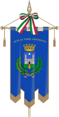
Gonfalone di Torre Annunziata
(c) Vonvikken, CC BY-SA 3.0 it
Map of the municipality (comune) of Torre Annunziata (province of Naples, region Campania, Italien)
Map of the Provincia of Napoli.


