Torkelsbo
| Torkelsbo | |
| By | |
| Land | |
|---|---|
| Landskap | Uppland |
| Län | Uppsala län |
| Kommun | Tierps kommun |
| Koordinater | 60°6′25″N 17°33′43″Ö / 60.10694°N 17.56194°Ö |
| Tidszon | CET (UTC+1) |
| - sommartid | CEST (UTC+2) |
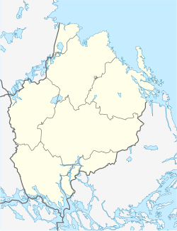
Torkelsbos läge i Uppsala län | |
Torkelsbo är en by i södra delen Vendels socken i Tierps kommun i Uppland.
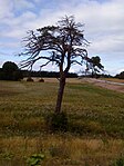
Torkelsbo ligger på Uppsalaåsens östra sida och omedelbart väster om E4. Byn är en av Tierps kommuns sydligaste byar. Den är känd bland annat för den s.k. Suptallen i Torkelsbo, vid vilken forna tiders vägfarande rastade.
Byn ligger cirka 2 kilometer norr om Läby och har vägförbindelse genom länsväg C 714. Den s.k. Torkelsbovägen är sedan den 2 april 2009 en helt privat väg och avstängd för all icke behörig trafik. Detta gäller även alla grustransporter.
Torkelsbo omtalas första gången 1528, då Uppsala helgeandshus hade en gård här i Torkelsbo Torkilsbodha som räntade 6 pund humle årligen. Ännu 1566 tillhörde Torkelsbo Uppsala helgeandshus.
Bildgalleri
- Infarten till Torkelsbo
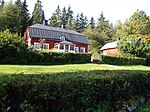
- Torkelsbo gård (historisk)
- Gammal smedja (?) i Torkelsbo
- Gammal smedja (?) i Torkelsbo
Källor
- Det medeltida Sverige, volym 1:4, Tiundaland.
Externa länkar
Media som används på denna webbplats
Författare/Upphovsman: Erik Frohne, Licens: CC BY 3.0
Location map of Uppsala county in Sweden
Equirectangular projection, N/S stretching 200 %. Geographic limits of the map:
- N: 60.80° N
- S: 59.30° N
- W: 16.60° E
- E: 18.90° E
Shiny red button/marker widget. Used to mark the location of something such as a tourist attraction.
Den gamla suptallen invid länsväg C 714 vid Torkelsbo, Gryttby, Vendels församling, Tierps kommun, Sverige. Tallen syns från motorvägen E4 strax norr om viadukten över E4.
Den historiska Torkelsbo gård
Torkelsbo - gammal timrad byggnad
Infart till Torkelsbo från länsväg C-714
Torkelsbo - gammal timmerbyggnad (smedja?)


