Tiverton, Rhode Island
| Tiverton, Rhode Island | |
| Kommun (town) | |
| Land | |
|---|---|
| Delstat | |
| County | Newport County |
| Höjdläge | 44 m ö.h. |
| Koordinater | 41°38′0″N 71°13′0″V / 41.63333°N 71.21667°V |
| Area | 94,02 km² |
| Folkmängd | 16 359 (2020)[2] |
| Befolkningstäthet | 174 invånare/km² |
| Grundad | 1659[1] |
| Tidszon | EST (UTC-5) |
| - sommartid | EDT (UTC-4) |
| ZIP-kod | 02878 |
| Riktnummer | 401 |
| GNIS-kod | 1220066 |
| Geonames | 5225245 |
Översiktskarta | |
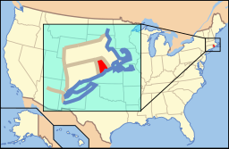
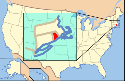
Rhode Islands läge i USA | |
| Wikimedia Commons: Tiverton, Rhode Island | |
| Webbplats: http://www.tiverton.ri.gov | |
| Redigera Wikidata | |
Tiverton är en kommun (town) i Newport County i delstaten Rhode Island, USA med cirka 15 260 invånare (2000). Den har enligt United States Census Bureau en area på 94,1 km².

Referenser
- ^ hämtat från: engelskspråkiga Wikipedia.[källa från Wikidata]
- ^ United States Census Bureau (red.), USA:s folkräkning 2020, läs online, läst: 1 januari 2022.[källa från Wikidata]
| ||||||||||
Media som används på denna webbplats
Författare/Upphovsman: Beyond My Ken, Licens: CC BY-SA 4.0
The A. P. White Store at 3883 Main Road in Tiverton, Rhode Island is part of the Tiverton Four Corners Historic District. Located on the northwest corner of the intersection of Main Road with Puncatest Neck Road (West Road), the two-story Victorian building with mansard roof and cupola and single-story wrap-around veranda was built in 1875 as a general store by Andrew Peregrine White, who owned and operated the nearby A. P White & Bro. mill complex with his brother Charles Henry White. (Source: NRHP nomination)
Författare/Upphovsman: This version: uploader
Base versions this one is derived from: originally created by en:User:Wapcaplet, Licens: CC BY 2.0
Map of USA with Rhode Island highlighted
Quaket River, Tiverton, Rhode Island


