Tiro, Ohio
| Tiro | |
| Bykommun (village) | |
| Land | |
|---|---|
| Delstat | |
| County | Crawford County |
| Höjdläge | 321 m ö.h. |
| Koordinater | 40°54′24″N 82°46′19″V / 40.90667°N 82.77194°V |
| Area | 1,07 km² (2010)[1] |
| Folkmängd | 219 (2020)[2] |
| Befolkningstäthet | 206 invånare/km² |
| Tidszon | EST (UTC-5) |
| - sommartid | EDT (UTC-4) |
| ZIP-kod | 44887 |
| GNIS-kod | 1061694 |
| Geonames | 5174007 |
Översiktskarta | |
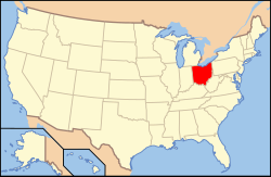
Ohios läge i USA | |
| Wikimedia Commons: Tiro, Ohio | |
| Redigera Wikidata | |
Tiro är en ort i Crawford County i delstaten Ohio, USA.
Referenser
- ^ United States Census Bureau, 2010 U.S. Gazetteer Files, United States Census Bureau, 2010, läst: 9 juli 2020.[källa från Wikidata]
- ^ United States Census Bureau (red.), USA:s folkräkning 2020, läs online, läst: 1 januari 2022.[källa från Wikidata]
Media som används på denna webbplats
Författare/Upphovsman: This version: uploader
Base versions this one is derived from: originally created by en:User:Wapcaplet, Licens: CC BY 2.0
Map of USA with Ohio highlighted
Författare/Upphovsman: Catbar på engelska Wikipedia, Licens: CC BY-SA 3.0
Map of Tiro.
Two community buildings on the western side of Main Street (State Route 39) at the Hilborn Avenue intersection in Tiro, Ohio, United States. The fire station sits in the foreground, while the farther building houses the local bar and the village's post office.


