Thornton, Texas
| Thornton, Texas | |
| Land | |
|---|---|
| Delstat | |
| County | Limestone County |
| Höjdläge | 150 m ö.h. |
| Koordinater | 31°24′36″N 96°34′25″V / 31.41000°N 96.57361°V |
| Area | 2,55 km² (2010)[1][2] |
| Folkmängd | 421 (2020)[3] |
| Befolkningstäthet | 165 invånare/km² |
| Tidszon | CST (UTC-6) |
| - sommartid | CDT (UTC-5) |
| ZIP-kod | 76687 |
| Riktnummer | 254 |
| GNIS-kod | 1369866 |
| Geonames | 4736679 |
Översiktskarta | |
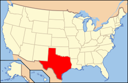
Texas läge i USA | |
| Redigera Wikidata | |
Thornton är en ort i Limestone County i delstaten Texas, USA.
Sanctuary Church har en kommunitet i Thornton vid Lake Limestone.[4]
Referenser
- ^ United States Census Bureau, 2016 U.S. Gazetteer Files, United States Census Bureau, 2016.[källa från Wikidata]
- ^ United States Census Bureau, 2010 U.S. Gazetteer Files, United States Census Bureau, 2010, läst: 9 juli 2020.[källa från Wikidata]
- ^ United States Census Bureau (red.), USA:s folkräkning 2020, läs online, läst: 1 januari 2022.[källa från Wikidata]
- ^ ”Gun Church That Worships With AR-15s Bought a 40-Acre Compound in Texas for Its ‘Patriots’” (på engelska). www.vice.com. https://www.vice.com/en/article/y3dp8j/gun-church-that-worships-with-ar-15s-bought-a-40-acre-compound-in-texas-for-its-patriots. Läst 5 augusti 2021.
Media som används på denna webbplats
Författare/Upphovsman: This version: uploader
Base versions this one is derived from: originally created by en:User:Wapcaplet, Licens: CC BY 2.0
Map of USA with Texas highlighted
Författare/Upphovsman: The original uploader was Seth Ilys på engelska Wikipedia., Licens: CC BY-SA 3.0
Adapted from Wikipedia's TX county maps by Seth Ilys.
Författare/Upphovsman: Renelibrary, Licens: CC BY-SA 4.0
Masonic Building in Thornton, Texas


