Tarakullen
| Tarakullen | |
| Hill of Tara | |
| Kulle | |
(c) Patrick Brown, CC BY-SA 2.0 | |
| Land | |
|---|---|
| Provins | Leinster |
| Grevskap | Meath |
| Koordinater | 53°34′39″N 6°36′43″V / 53.57750°N 6.61194°V |
| Tidszon | UTC (UTC+0) |
| - sommartid | BST (UTC+1) |
| Geonames | 2961270 |
Läge i Irland | |
Tarakullen (engelska: Hill of Tara, iriska: Teamhair na Rí, "kungarnas kulle") ligger vid floden Boyne i grevskapet Meath i Leinster på Irland,[1]och är en låg stenkantad ås med ett antal gamla monument i närheten. Tara kan ha varit huvudsäte för Irlands högkungar. Norr om åsen ligger resterna av ett nästan cirkelrunt järnåldersfort och med en diameter på 1000 meter. Lämningarna är kända som kungarnas fort och det finns flera andra försvarsanläggningar i närheten. Utgrävningar har även visat på romerska lämningar från 100-talet till 300-talet efter Kristus.[2][3][4][5]
Det har också visat sig vid utgrävningar att det finns lämningar efter monument som dateras till cirka 3000 före Kristus och att Tara kan ha varit en kalender. En annan teori säger att Tara kan ha varit huvudstaden för de folk som fanns här före kelterna och när sedan kelterna kom tog de över Tara. Det är mycket troligt att Tara hade en stor politisk och ekonomisk betydelse.[6][7][8][9]
Även under senare tid har Tara spelat en betydande roll. Under revolutionen 1798 hade de irländska rebellerna sitt läger på kullen. Man blev besegrad av den engelska armén och de 400 rebeller som stupade begravdes på Tara.[10][11][12]
Bildgalleri
- (c) Verdasuno, CC BY-SA 3.0Tara -stenen, Lia Fail, ödets sten.
- Mound of hostages.
- Kyrkan vid Tarakullen.
- Mound of hostages.
- Tarakullen uppifrån.
- Tara-stenen, Lia Fail, Ödets sten.
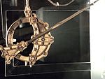
- Tara broschen på National Museet i Dublin.
- Högkors vid Tarakullen.
- Sankt Patricks kyrka interör, Tarakullen.
Se även
Referenser
- Den här artikeln är helt eller delvis baserad på material från engelskspråkiga Wikipedia, tidigare version.
Noter
- ^ ”Heritage Ireland: Hill of Tara” (på engelska). www.heritageireland.ie. http://www.heritageireland.ie/en/midlands-eastcoast/hilloftara/. Läst 22 augusti 2017.
- ^ ”Hill of Tara | Attractions | Museums and Attractions | All Ireland | Republic of Ireland | Meath | Dunshaughlin | All Ireland | Republic Of Ireland | Meath | Tara | Discover Ireland”. www.discoverireland.ie. http://www.discoverireland.ie/Arts-Culture-Heritage/hill-of-tara/9805. Läst 22 augusti 2017.
- ^ ”Sunday Drive Bucket List: Hill of Tara” (på engelska). www.irishcountrymagazine.ie. Arkiverad från originalet den 22 augusti 2017. https://web.archive.org/web/20170822220720/http://www.irishcountrymagazine.ie/sunday-drive-bucket-list-hill-of-tara-265185/. Läst 22 augusti 2017.
- ^ ”Ancient secrets of the Hill of Tara revealed (PHOTOS)” (på engelska). IrishCentral.com. 2 januari 2016. https://www.irishcentral.com/roots/ancient-secrets-of-tara-hill-revealed-99089684-237706481. Läst 22 augusti 2017.
- ^ ”Saint Patrick and the Hill of Tara”. RTÉ Archives. http://www.rte.ie/archives/2016/0315/775054-saint-patrick-and-the-hill-of-tara/. Läst 22 augusti 2017.
- ^ ”Crowds gather for summer solstice on the Hill of Tara” (på engelska). www.irishtimes.com. https://www.irishtimes.com/news/ireland/irish-news/crowds-gather-for-summer-solstice-on-the-hill-of-tara-1.3127748?mode=amp. Läst 22 augusti 2017.
- ^ Fiegl, Amanda. ”Ireland’s Endangered Cultural Site” (på engelska). Smithsonian. http://www.smithsonianmag.com/travel/irelands-endangered-cultural-site-51845458/. Läst 22 augusti 2017.
- ^ ”Tara | hill, Ireland” (på engelska). Encyclopedia Britannica. https://www.britannica.com/place/Tara-hill-Ireland. Läst 22 augusti 2017.
- ^ Winters, Riley. ”Following the Footsteps of the High Kings of Ireland at the Sacred Hill of Tara” (på engelska). Ancient Origins. http://www.ancient-origins.net/ancient-places-europe/following-footsteps-high-kings-ireland-sacred-hill-tara-005921. Läst 22 augusti 2017.
- ^ ”Hill of Tara” (på engelska). World Monuments Fund. https://www.wmf.org/project/hill-tara. Läst 22 augusti 2017.
- ^ ”Wexford Croppies' Graves In Meath” (på engelska). www.irishtimes.com. https://www.irishtimes.com/opinion/wexford-croppies-graves-in-meath-1.137942?mode=amp. Läst 22 augusti 2017.
- ^ ”Louth and the failure of the 1798 rebellion - Independent.ie” (på engelska). Independent.ie. http://m.independent.ie/regionals/droghedaindependent/localnotes/louth-and-the-failure-of-the-1798-rebellion-27105727.html. Läst 22 augusti 2017.
Externa länkar
 Wikimedia Commons har media som rör Tara-kullen.
Media som används på denna webbplats
Shiny red button/marker widget. Used to mark the location of something such as a tourist attraction.
Författare/Upphovsman: Johnbod, Licens: CC BY-SA 3.0
Tara Brooch in the National Museum of Ireland, Dublin. Front (feel free to rotate)
Författare/Upphovsman: Martinvl, Licens: CC BY-SA 4.0
Mound of Hostages on the Hill of Tara
Författare/Upphovsman: Nemoi, Licens: CC BY-SA 3.0
Site of the Hill of Tara, County Meath, Ireland
Författare/Upphovsman: Alison Cassidy, Licens: CC BY-SA 4.0
The Hill of Tara, as seen from the air. Taken from a hot-air balloon, Summer 2016.
Författare/Upphovsman: Alanna Milbourne, Licens: CC BY-SA 4.0
Hill of Tara
Författare/Upphovsman: Digital Eye, Licens: CC BY-SA 4.0
An interior view of St. Patrick's Church on the Hill of Tara.
(c) Verdasuno, CC BY-SA 3.0
Hill of Tara - the standing stone.
Author: Przemysław Sakrajda (Jul. 2005)Författare/Upphovsman: Nilfanion, Licens: CC BY-SA 3.0
Relief location map of Ireland
Equirectangular map projection on WGS 84 datum, with N/S stretched 170%
Geographic limits:
- West: 11.0° W
- East: 5.0° W
- North: 55.6° N
- South: 51.2° N
Författare/Upphovsman: Nemoi, Licens: CC BY-SA 3.0
Site of the Hill of Tara, County Meath, Ireland
Författare/Upphovsman: Neil Forrester, Co.Meath, Ireland.
http://neil.forrester.ie, Licens: CC BY 3.0
Commemorative cross erected during the 150th anniversary commemoration of the battle in 1948.


