Tammerfors–Haapamäki-banan
| Tammerfors–Haapamäki-banan | |
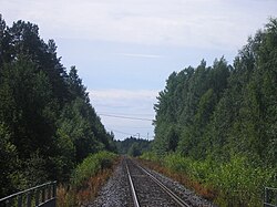
 Banan mellan Juupajoki och Vilppula | |
| Antal stationer | 7 |
|---|---|
| Organisation | |
| Trafikoperatör | VR |
| Tekniska fakta | |
| Längd | 107 kilometer |
| Elektrifierad | nej |
| Tammerfors-Haapamäki-banan | |||||||||||||||||||||||||||||||||||||||||||||||||||||||||||||||||||||||||||||||||||||||||||||||||||||||||||||||||||||||||||||||||||||||||||||||||||||||||||||||||||||||||||||||||||||||||||||||||||||||||||||
|---|---|---|---|---|---|---|---|---|---|---|---|---|---|---|---|---|---|---|---|---|---|---|---|---|---|---|---|---|---|---|---|---|---|---|---|---|---|---|---|---|---|---|---|---|---|---|---|---|---|---|---|---|---|---|---|---|---|---|---|---|---|---|---|---|---|---|---|---|---|---|---|---|---|---|---|---|---|---|---|---|---|---|---|---|---|---|---|---|---|---|---|---|---|---|---|---|---|---|---|---|---|---|---|---|---|---|---|---|---|---|---|---|---|---|---|---|---|---|---|---|---|---|---|---|---|---|---|---|---|---|---|---|---|---|---|---|---|---|---|---|---|---|---|---|---|---|---|---|---|---|---|---|---|---|---|---|---|---|---|---|---|---|---|---|---|---|---|---|---|---|---|---|---|---|---|---|---|---|---|---|---|---|---|---|---|---|---|---|---|---|---|---|---|---|---|---|---|---|---|---|---|---|---|---|---|
| |||||||||||||||||||||||||||||||||||||||||||||||||||||||||||||||||||||||||||||||||||||||||||||||||||||||||||||||||||||||||||||||||||||||||||||||||||||||||||||||||||||||||||||||||||||||||||||||||||||||||||||
Tammerfors–Haapamäki-banan är en bansträcka i Finland som går från Tammerfors via Orivesi till Haapamäki. Banan färdigställdes 1882. År 1897 förbands Mänttä till banan genom en enskild järnväg från Filpula med spårvidd 600 mm.
Sträckan Tammerfors-Orivesi är elektrifierad, dubbelspårig, och har 140 km/h som högsta tillåtna hastighet. Sträckan Orivesi-Haapamäki är inte elektrifierad, enkelspårig och har högsta tillåtna hastighet 100 km/h[1].
Lyly järnvägsstation är en nedlagd järnvägsstation på banan i Juupajoki, cirka 10 kilometer norr om kommuncentrum.
Stationer
Orivesi
Orivesi Centrum
Juupajoki
Källor
- ^ ”Rautateiden verkkoselostus” (på fi-FI). Väylävirasto. http://vayla.fi/ammattiliikenne-raiteilla/rautateiden-verkkoselostus. Läst 10 juni 2020.
Media som används på denna webbplats
This is the "empty element" of the Icons for railway descriptions (see there for further informations). The original syntax of Wikipedia:Route diagram templates filled all empty spaces in a diagram with this file (all BSicons were 20x20px). For those cells where an icon ID was provided, some "File:BSicon_ID.svg" were used, and where there was no ID, "File:BSicon_.svg" was substituted. Many major Wikipedias has since upgraded the syntax so that just an empty table cell is used (incl. En.WP).
station straight track
flag stop track straight in use
track to left against driving direction (with exact circles)
track to right forward driving direction (with exact circles)
junction straight to the left from the left (with exact circles)
Författare/Upphovsman: junafani, Licens: CC BY-SA 3.0
Kolho railway station in Mänttä-Vilppula, Finland
Författare/Upphovsman: junafani, Licens: CC BY-SA 3.0
Vilppula railway station
Författare/Upphovsman: Visa580, Licens: CC BY 2.5
Tracks 1 and 2 in Tampere railway station
Författare/Upphovsman: Otto Karikoski, Licens: CC BY-SA 3.0
Orivesi center railway halt.
non-passenger stop track straight in use
non-passenger station track straight in use
Track change (new design)
Författare/Upphovsman: Otto Karikoski, Licens: CC BY-SA 3.0
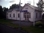
Juupajoki railway halt.
Författare/Upphovsman: Vesahjr, Licens: CC BY-SA 4.0
VR Class Dm12 diesel multiple units at Haapamäki railway station in Keuruu, Finland.
Ex flag stop, track straight in use
Författare/Upphovsman: Antti Leppänen, Licens: CC BY-SA 3.0
Tampere–Haapamäki railway south of Vilppula, Finland, towards Tampere.
Författare/Upphovsman: junafani, Licens: CC BY-SA 3.0
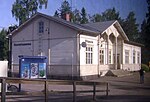
Orivesi railway station in Finland.


