Tótkomlós
| Tótkomlós | ||
| Stad | ||
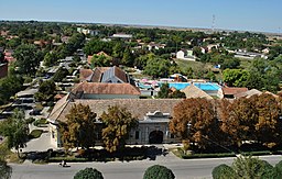
Utsikt från kyrktornet | ||
| ||
| Land | Ungern | |
|---|---|---|
| Region | Békés | |
| Koordinater | 46°25′01″N 20°43′59″Ö / 46.417°N 20.733°Ö | |
| Area | 125,40 km² | |
| Folkmängd | 5 615 (2019) | |
| Befolkningstäthet | 44,8 invånare/km² | |
| Tidszon | CET (UTC+1) | |
| - sommartid | CEST (UTC+2) | |
| Postnummer | 5940 | |
| Riktnummer | 68 | |
| Geonames | 714548 | |
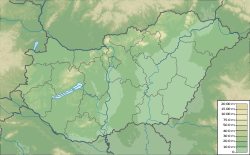
Läge i Ungern. | ||
Tótkomlós är en mindre stad i Ungern med 5 615 invånare (2019).[1]
Källor
- ^ ”Detailed Gazetteer of Hungary” (på engelska). http://www.ksh.hu/apps/hntr.telepules?p_lang=EN&p_id=16434. Läst 3 augusti 2020.
| |||||||||
Media som används på denna webbplats
Shiny red button/marker widget. Used to mark the location of something such as a tourist attraction.
Författare/Upphovsman: Urutseg, Licens: CC0
Hungary physical map, parameters equal to File:Hungary location map.svg
Författare/Upphovsman: Patrik Kunec, Licens: CC BY-SA 4.0
Tótkomlós, Hungary - view from the church tower
Författare/Upphovsman: Kaboldy, Licens: CC BY-SA 4.0
Coat of arms of Tótkomlós, Hungary


