Tétange
| Tétange | |
| Ort | |
Kulturcentret Schungfabrik | |
| Land | |
|---|---|
| Höjdläge | 300 m ö.h. |
| Koordinater | 49°28′33″N 6°02′32″Ö / 49.47583°N 6.04222°Ö |
| Folkmängd | 2 929 (2012-01-18)[1] |
| Geonames | 2960042 |
Tétange (luxemburgska: Téiteng, tyska: Tetingen) är en ort i kommunen Frisange i kantonen Esch-sur-Alzette i Luxemburg.[1] Tétange ligger 300 meter över havet och antalet invånare är 2 929.[1]
Bildgalleri
- Église Saint-Joseph, Tétanges kyrka, byggd 1897
- Järnvägsstationen i Tétange
- Vy från parken Querbett i Kayl mot Tétange i sydsydväst, Kyrkan i Tétanges syns i bakgrunden till vänster.
- Naturreservatet Haard
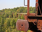
- (c) johnnyzoom, CC BY 3.0Tidigare dagbrott i Haard
Källor
Noter
- ^ [a b c] Tétange hos GeoNames.Org (cc-by); post uppdaterad 2012-01-18; databasdump nerladdad 2015-11-01
Externa länkar
 Wikimedia Commons har media som rör Tétange.
Media som används på denna webbplats
Shiny red button/marker widget. Used to mark the location of something such as a tourist attraction.
Författare/Upphovsman: Cayambe, Licens: CC BY-SA 4.0
Luxembourg, Kayl: rural landscape towards Tétange (SSW) as seen from the public park Ouerbett. The church of Tétange is seen in the background at left.
Författare/Upphovsman: Edy Nicola at lb.wikipedia, Licens: CC BY-SA 3.0
Schungfabrik zu Téiteng
(c) johnnyzoom, CC BY 3.0
Old mining machine takes on colour of earth
Författare/Upphovsman: Carport, Licens: CC BY-SA 3.0
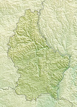
Physical location map of Luxembourg
Författare/Upphovsman: Cayambe, Licens: CC BY-SA 4.0
Nature reserve Haard in Luxembourg.


