Statesboro
| Statesboro | |
| city | |
| Land | |
|---|---|
| Delstat | Georgia |
| County | Bulloch County |
| Koordinater | 32°26′28″N 81°46′28″V / 32.44111°N 81.77444°V |
| Yta | 35,9 km² (2010)[1] |
| - land | 35 km² |
| - vatten | 0,9 km² |
| Folkmängd | 29 399 (2011)[2] |
| Befolkningstäthet | 840 invånare/km² |
| Tidszon | EST (UTC-5) |
| - sommartid | EDT (UTC-4) |
| ZIP-kod | 30458, 30460–30461[3] |
| FIPS | 1373256 |
| Geonames | 4224413 |
Ortens läge i Georgia | |
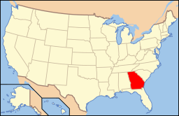
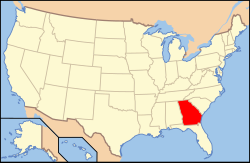
Georgias läge i USA | |
Statesboro är en stad (city) i Bulloch County, i delstaten Georgia, USA. Enligt United States Census Bureau har staden en folkmängd på 29 399 invånare (2011) och en landarea på 35 km². Statesboro är huvudort i Bulloch County. Georgia Southern University ligger i staden.
Källor
- ^ ”2010 Census Gazetteer Files”. US Census Bureau. Arkiverad från originalet den 14 juli 2012. https://www.webcitation.org/699nOulzi?url=http://www.census.gov/geo/www/gazetteer/files/Gaz_places_national.txt. Läst 14 juli 2012.
- ^ ”Annual Estimates of the Resident Population for Incorporated Places: April 1, 2010 to July 1, 2011”. Arkiverad från originalet den 22 juli 2012. https://www.webcitation.org/69Lw97QGw?url=http://www.census.gov/popest/data/cities/totals/2011/tables/SUB-EST2011-03-13.csv. Läst 22 juli 2012.
- ^ ”2010 ZIP Code Tabulation Area (ZCTA) Relationship Files”. U.S. Census Bureau. 8 augusti 2010. Arkiverad från originalet den 25 augusti 2012. https://www.webcitation.org/6ABdwXxbq?url=http://www.census.gov/geo/www/2010census/zcta_rel/zcta_place_rel_10.txt. Läst 25 augusti 2012.
Externa länkar
- State & County QuickFacts, US Census Bureau.
 Wikimedia Commons har media som rör Statesboro.
Media som används på denna webbplats
Shiny red button/marker widget. Used to mark the location of something such as a tourist attraction.
Författare/Upphovsman: Alexrk2, Licens: CC BY 3.0
Den här Det karta skapades med GeoTools.
Författare/Upphovsman: The original uploader was Richardelainechambers på engelska Wikipedia., Licens: CC BY-SA 3.0
View of Georgia Southern campus from Forest Dr looking between Education and Nursing buildings. Photo taken Richard Chambers, Aug-2004.
Between the College of Education building on the left and the College of Nursing building on the right, you can see the College of Information Technology building.
Other images in this series:
Författare/Upphovsman: This version: uploader
Base versions this one is derived from: originally created by en:User:Wapcaplet, Licens: CC BY 2.0
Map of USA with Georgia highlighted


