Stabroek
| Stabroek | |||
| Stabroek | |||
| Kommun | |||
| |||
| Land | |||
|---|---|---|---|
| Federal region | Flandern | ||
| Provins | Antwerpen | ||
| Arrondissement | Arrondissement Antwerpen | ||
| Koordinater | 51°20′0″N 4°22′0″Ö / 51.33333°N 4.36667°Ö | ||
| Centralort | Stabroek | ||
| Area | 21,51 km² | ||
| Folkmängd | 18 529 (2018)[3] | ||
| Befolkningstäthet | 861 invånare/km² | ||
| Politik | |||
| - Borgmästare | Rik Frans (2013–) (N-VA)[2] | ||
| Tidszon | CET (UTC+1) | ||
| - sommartid | CEST (UTC+2) | ||
| Postnummer | 2940[1] och 2091[1] | ||
| Riktnummer | 03 | ||
| Kommunkod | 11044 | ||
| Geonames | 2786230 | ||
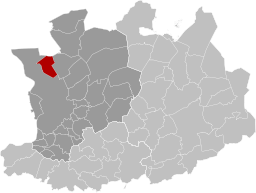
Översiktskarta | |||
Provinsens läge i Belgien | |||
| Wikimedia Commons: Stabroek | |||
| Webbplats: http://www.stabroek.be/ | |||
| Redigera Wikidata | |||
Stabroek är en kommun i Belgien.[4] Den ligger i provinsen Antwerpen och regionen Flandern, i den norra delen av landet, 50 km norr om huvudstaden Bryssel. Antalet invånare är 17 939.[4] Stabroek gränsar till Kapellen, Woensdrecht och Antwerpen.
Källor
- ^ [a b] Crossroads Bank for Enterprises.[källa från Wikidata]
- ^ Rik Frans (på nederländska), läs online, läst: 7 maj 2021.[källa från Wikidata]
- ^ Wettelijke Bevolking per gemeente op 1 januari 2018 (på nederländska), Algemene Directie Statistiek, läs online, läst: 9 mars 2019.[källa från Wikidata]
- ^ [a b] Stabroek hos GeoNames.Org (cc-by); post uppdaterad 2011-02-07; databasdump nerladdad 2015-11-14
Externa länkar
 Wikimedia Commons har media som rör Stabroek.
Media som används på denna webbplats
The civil ensign and flag of Belgium. It is identical to Image:Flag of Belgium.svg except that it has a 2:3 ratio, instead of 13:15.
Författare/Upphovsman: TUBS
Location of xy province/ region/ community (see filename) in Belgium.
Flag of the Belgian municipality of Stabroek.
The municipal flag of Stabroek is horizontally divided yellow-blue with three eight-pointed stars: the first one, blue, in the left part of the yellow stripe; the second one, yellow, in the left part of the blue stripe; and the third one, counterchanged, near the middle of the flag.Författare/Upphovsman: John Scholte, Licens: CC BY-SA 4.0
This is a photo of onroerend erfgoed number
Författare/Upphovsman: OD02fr, Licens: CC BY-SA 4.0
Map of Stabroek in province of Antwerp, Belgium.


