St. Paul, Collin County, Texas
| St. Paul | |
| Land | |
|---|---|
| Delstat | |
| County | Collin County |
| Höjdläge | 161 m ö.h. |
| Koordinater | 33°2′28″N 96°33′1″V / 33.04111°N 96.55028°V |
| Area | 3,97 km² (2010)[1] |
| Folkmängd | 992 (2020)[2] |
| Befolkningstäthet | 250 invånare/km² |
| Tidszon | CST (UTC-6) |
| - sommartid | CDT (UTC-5) |
| GNIS-kod | 1388610 |
| Geonames | 4725484 |
Översiktskarta | |
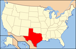
Texas läge i USA | |
| Wikimedia Commons: St. Paul, Collin County, Texas | |
| Redigera Wikidata | |
St. Paul är en ort i Collin County i delstaten Texas, USA.
Referenser
- ^ United States Census Bureau, 2010 U.S. Gazetteer Files, United States Census Bureau, 2010, läst: 9 juli 2020.[källa från Wikidata]
- ^ United States Census Bureau (red.), USA:s folkräkning 2020, läs online, läst: 1 januari 2022.[källa från Wikidata]
Media som används på denna webbplats
This map shows the incorporated areas in Collin County, Texas. Saint Paul is highlighted in red. I created it in Inkscape using data from the Collin County GIS Website ([1]) and the North Central Texas Council of Governments Website ([2]).
Författare/Upphovsman: This version: uploader
Base versions this one is derived from: originally created by en:User:Wapcaplet, Licens: CC BY 2.0
Map of USA with Texas highlighted


