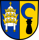
St. Leon-Rot
| St. Leon-Rot | ||
| Kommun | ||
Kommunalhuset. | ||
| ||
| Land | ||
|---|---|---|
| Förbundsland | Baden-Württemberg | |
| Regierungsbezirk | Karlsruhe | |
| Kreis | Rhein-Neckar-Kreis | |
| Höjdläge | 107 m ö.h. | |
| Koordinater | 49°15′28″N 8°36′59″Ö / 49.257778°N 8.616389°Ö | |
| Yta | 25,56 km² ()[1][2] | |
| Folkmängd | 13 909 ()[3] | |
| Befolkningstäthet | 544 inv./km² | |
| Postnummer | 68789 | |
| Riktnummer | (+49) 06227 | |
| Registreringsskylt | HD | |
| Kommunkod | 08 2 26 103 | |
| Regionalkod | 08 2 26 0103 08 2 26 0103 103 | |
| Geonames | 6555681 | |
| OSM-karta | 453402 | |
Läget för St. Leon-Rot i Tyskland | ||
Läget för St. Leon-Rot i Rhein-Neckar-Kreis | ||
| Webbplats: St. Leon-Rot | ||
St. Leon-Rot är en kommun och ort i Rhein-Neckar-Kreis i regionen Rhein-Neckar i Regierungsbezirk Karlsruhe i förbundslandet Baden-Württemberg i Tyskland.[4]
Referenser
- ^ läs online, www.statistik.baden-wuerttemberg.de .[källa från Wikidata]
- ^ Alle politisch selbständigen Gemeinden mit ausgewählten Merkmalen am 31.12.2018 (4. Quartal) (på tyska), Statistisches Bundesamt, läs online, läst: 10 mars 2019.[källa från Wikidata]
- ^ Alle politisch selbständigen Gemeinden mit ausgewählten Merkmalen am 31.12.2022, Statistisches Bundesamt, 21 september 2023, läs online, läst: 7 oktober 2023.[källa från Wikidata]
- ^ ”Alle politisch selbständigen Gemeinden mit ausgewählten Merkmalen am 31.03.2020” (Excel). Statistisches Bundesamt. 2020. https://www.destatis.de/DE/Themen/Laender-Regionen/Regionales/Gemeindeverzeichnis/Administrativ/Archiv/GVAuszugQ/AuszugGV1QAktuell.xlsx?__blob=publicationFile. Läst 1 januari 2021.
|
Media som används på denna webbplats
Shiny red button/marker widget. Used to mark the location of something such as a tourist attraction.
Författare/Upphovsman: Frank, Licens: CC BY-SA 2.5
Town hall in St. Leon-Rot
Författare/Upphovsman: TUBS
Location map of Germany with waterbodies
|
|
|
|
|
|
|
|


