Sogndals kommun
| Sogndals kommun | ||
| Sogndal kommune | ||
| Kommun | ||
| Land | ||
|---|---|---|
| Fylke | Vestland fylke | |
| Koordinater | 61°13′47″N 7°6′2″Ö / 61.22972°N 7.10056°Ö | |
| Centralort | Sogndal | |
| Area | 1 472,82 km² (2020)[3] | |
| - land | 1 229,99 km² (2020) | |
| - vatten | 134,77 km² | |
| Folkmängd | 12 198 (2023)[4] | |
| Befolkningstäthet | 10 invånare/km² | |
| Politik | ||
| - Kommunstyrelsens ordförande | Arnstein Menes (2020–) | |
| Tidszon | CET (UTC+1) | |
| - sommartid | CEST (UTC+2) | |
| Kommunkod | 4640 (2020–) 1420 (–2019) | |
| Geonames | 3137974 | |
| Målform | nynorska | |
 Sogndals kommun i Vestland fylke. | ||
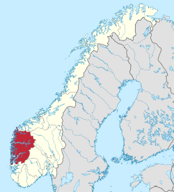
(c) Karte: NordNordWest, Lizenz: Creative Commons by-sa-3.0 de Vestland fylke i Norge. | ||
| Wikimedia Commons: Sogndal | ||
| Webbplats: https://www.sogndal.kommune.no/ | ||
| Redigera Wikidata | ||
Sogndals kommun (norska: Sogndal kommune) är en kommun i landskapet Sogn i Vestland fylke i västra Norge. Tätorten Sogndal (Sogndalsfjøra) utgör kommunens centralort. Den är en av de fruktodlingsintensivaste kommunerna i Norge.
Kommunen omfattar en del av Jostedalsbreen nationalpark.
Administrativ historik
Sogndals kommun upprättades den 1 januari 1838 (som Sogndal formannskapsdistrikt) när Formannskapslovene från 1837 trädde i kraft. Kommunen omfattade då ett område i den östra delen av den nuvarande kommunen.
Den 1 januari 1964 överfördes ett bebott område (Tingstads allmänning med fem invånare) från Leikangers kommun till Sogndals kommun.[5]
Den 1 januari 2000 överfördes Fjærlands socken från Balestrands kommun till Sogndals kommun.
Den 1 januari 2020 utökades kommunen med de tidigare kommunerna Balestrand och Leikanger.[6]
Upphörda kommunvapen inom den nuvarande kommunen
- Balestrands kommun
(1989–2019) - Leikangers kommun
(1963–2019) - Sogndals kommun
(1984–2019)
Tätorter
I Sogndals kommun finns fem tätorter:[7]
- Balestrand
- Hermansverk/Leikanger
- Kaupanger
- Kjørnes
- Sogndalsfjøra (centralort)
Socknar
Inom Norska kyrkan är Sogndals kommun indelad i sex socknar:[8]
- Fjærlands socken
- Kaupangers socken
- Leikangers socken
- Norums socken
- Stedje socken
- Balestrands socken
Socknarna ingår i Sogns prosteri i Bjørgvins stift.[8]
Bilder
- Fosshaugane campus.
- Sognahallen.
- Stedjeberget.
Kända personer
- Gjest Baardsen
- Liv Signe Navarsete
- Tone Damli Aaberge
- Minda Ramm
Källor
- ^ Dag Juvkam, Historisk oversikt over endringer i kommune- og fylkesinndelingen, Statistisk sentralbyrå, maj 1999, s. 56, ISBN 82-537-4684-9, läs online.[källa från Wikidata]
- ^ läs online, www.ssb.no .[källa från Wikidata]
- ^ Statens kartverk, Arealstatistikk for Norge 2020, Statens kartverk, 20 december 2019, läs online.[källa från Wikidata]
- ^ 07459: Alders- og kjønnsfordeling i kommuner, fylker og hele landets befolkning (K) 1986 - 2023 (på norskt bokmål), Statistisk sentralbyrå, 21 februari 2023, läs online.[källa från Wikidata]
- ^ ”Historisk oversikt over endringer i kommune- og fylkesinndelingen” (PDF). Statistisk sentralbyrå. Maj 1999. https://www.ssb.no/a/publikasjoner/pdf/rapp_9913/rapp_9913.pdf.
- ^ ”En rekke regionendringer ble iverksatt 1.1.2020” (på norska). https://www.ssb.no/offentlig-sektor/kommunekatalog/endringer-i-de-regionale-inndelingene#Alle_kommuneendringer_18382017. Läst 1 september 2020.
- ^ ”Tettsteders befolkning og areal”. Statistisk sentralbyrå. 12 december 2023. https://www.ssb.no/befolkning/folketall/statistikk/tettsteders-befolkning-og-areal.
- ^ [a b] Store norske leksikon
Externa länkar
- Officiell webbplats
 Wikimedia Commons har media som rör Sogndals kommun.
| |||||||
| ||||||||||
Media som används på denna webbplats
Coat of arms for the Norwegian municipality of Leikanger.
Coat of arms for the Norwegian municipality of Sogndal.
Författare/Upphovsman: User:China_Crisis, Licens: CC BY-SA 2.5
The Fjaerlandfjord, a branch of the Sognefjord, near Fjærland, Norway.
Författare/Upphovsman: Thomas Mues, Licens: CC BY-SA 2.0
The Sognefjord in Norway as seen from the Storehaugen mountain. At the left, the village of Kaupanger.
Författare/Upphovsman: Jay1279, Licens: CC0
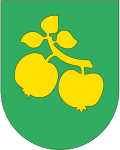
Coat of arms of Sogndal Municipality in Vestland county, Norway (effective 1 Jan 2020)
Författare/Upphovsman: Gutten på Hemsen, Licens: CC0
Flag of Norway with colors from the previous version on Commons. This file is used to discuss the colors of the Norwegian flag.
Författare/Upphovsman: Jay1279, Licens: CC0
Map of Sogndal Municipality in Vestland county, Norway
(c) Karte: NordNordWest, Lizenz: Creative Commons by-sa-3.0 de
Location of county Vestland in Norway (2024)
Coat of arms for Vestland county, Norway
Coat of arms for Sogn og Fjordane county (fylke), Norway.The coat of arms were granted on 23 September 1983. The arms show the geographical layout of the county: three large fjords protruding into the land. The three fjords are the Nordfjord, Sunnfjord and Sognefjord. As nearly all villages and towns are situated on one of these fjords and the name of the county is based on the fjords.


