Sofielunds församling
| Sofielunds församling Före detta församling | |
 | |
| Land | Sverige |
|---|---|
| Kommun | Malmö kommun[1] |
| Trossamfund | Svenska kyrkan |
| Stift | Lunds stift |
| Bildad | 1 januari 1969 |
| av del av | Västra Skrävlinge församling |
| Upphörd | 31 december 2001 |
| Uppgått i | Möllevången-Sofielunds församling |
| Upphov till | Sofielunds distrikt |
| Karta | |
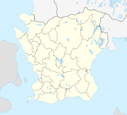
Sofielunds församlings läge i Skåne län. | |
| Koordinat | 55°35′21″N 13°01′16″Ö / 55.589166666667°N 13.021111111111°Ö |
| Koder, länkar | |
| Församlingskod | 128015 |
| Kyrkoarkiv | SE/MSA/01133 |
| Redigera Wikidata | |
Sofielunds församling var en församling i Lunds stift och i Malmö kommun. Församlingen uppgick 2002 i Möllevången-Sofielunds församling.
Administrativ historik
Församlingen bildades 1969 genom en utbrytning ur Västra Skrävlinge församling. Församlingen utgjorde till 2002 ett eget pastorat.[2] Församlingen uppgick 2002 i Möllevången-Sofielunds församling.[3]
Kyrkor
Källor
- ^ Nationell Arkivdatabas Referenskod: SE/128015000, läst: 29 augusti 2018.[källa från Wikidata]
- ^ ”Förteckning (Sveriges församlingar genom tiderna)”. Skatteverket. 1989. http://www.skatteverket.se/privat/folkbokforing/omfolkbokforing/folkbokforingigaridag/sverigesforsamlingargenomtiderna/forteckning.4.18e1b10334ebe8bc80003999.html. Läst 17 december 2013.
- ^ ”Församlingar”. Statistiska centralbyrån. https://www.scb.se/hitta-statistik/regional-statistik-och-kartor/regionala-indelningar/forsamlingar/. Läst 20 december 2020.
Media som används på denna webbplats
Shiny red button/marker widget. Used to mark the location of something such as a tourist attraction.
Författare/Upphovsman: Sebras, Licens: CC BY-SA 3.0
i RAÄ:s bebyggelseregister (BBR).
Författare/Upphovsman: Erik Frohne, Licens: CC BY 3.0
Location map of Scania (Skåne) in Sweden
Equirectangular projection, N/S stretching 179 %. Geographic limits of the map:
- N: 56° 37' N
- S: 55° 12' N
- W: 12° 12' E
- E: 15° 00' E


