Snaefell
not parsed now - please come back in a few minutesMedia som används på denna webbplats
Shiny red button/marker widget. Used to mark the location of something such as a tourist attraction.
(c) M J Richardson, CC BY-SA 2.0
Snaefell and North Barrule The summit area of Snaefell by the NATS tower, looking NE along the ridge to North Barrule
(c) Trevor Rickard, CC BY-SA 2.0
Two cars at the summit station Behind the cars is the radio mast at the top of Snaefell.
Författare/Upphovsman:
- IsleOfMan_SheadingsAndParishes-en.svg: Sémhur
- derivative work: Entlinkt (talk)
Location map of the Isle of Man, showing sheadings as well as local authorities (towns, villages, districts, parishes).
Geographic limits of the map:
- W: -4° 58' 0"
- E: -4° 7' 0"
- S: 54° 0' 0"
- N: 54° 27' 30"
Författare/Upphovsman: Fry1989 eh?, Licens: CC0
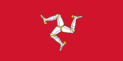
Flag of the Isle of Mann. This version has the triskelion centered as a whole rather than based upon the imaginary circle created by the prongs of each leg.


