Sirena Deep
| Sirena Deep | |
| Mariana Trench Marine National Monument - Trench Unit, HMRG Hawaii Mapping Research Group | |
| Djup | |
| Territorium | |
|---|---|
| Koordinater | 12°03′55″N 144°34′52″Ö / 12.0654°N 144.58113°Ö |
| Tidszon | AEST (UTC+10) |
| Geonames | 7778679 |
Läge i Guam | |
Sirena Deep är världens näst djupaste plats i världshavet efter Marianergraven som inte ligger långt ifrån denna plats. Den ligger inom Guams territorium (USA).[1] Det ligger i den södra delen av Guam, 160 km söder om huvudstaden Hagåtña. Sirena Deep upptäcktes 1997. Det maximala djupet ligger 10 732 m under havsytan.
Källor
- ^ Mariana Trench - HMRG Deep hos Geonames.org (cc-by); post uppdaterad 2011-07-08; databasdump nerladdad 2015-05-23
Media som används på denna webbplats
Shiny red button/marker widget. Used to mark the location of something such as a tourist attraction.
The flag of Guam, courtesy an e-mail from the author of xrmap. Modifications by Denelson83.
Författare/Upphovsman: Uwe Dedering, Licens: CC BY-SA 3.0
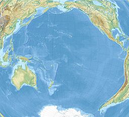
Relief location map of Pacific_Ocean.
- Projection: Lambert azimuthal equal-area projection.
- Area of interest:
- N: 60.0° N
- S: −80.0° N
- W: −260.0° E
- E: −70.0° E
- Projection center:
- NS: −10.0° N
- WE: −165.0° E
- GMT projection: -JA-165.0/-10.0/180/19.998266666666666c
- GMT region: -R-320.2519138145009/-12.459450078533589/-5.473602099069988/26.40516525873812r
- GMT region for grdcut: -R-325.0/-90.0/-5.0/74.0r
- Relief: SRTM30plus.
- Made with Natural Earth. Free vector and raster map data @ naturalearthdata.com.


