Sinoe County
| Sinoe County | ||
| Sino County, Sinoe | ||
| Region | ||
| ||
| Land | ||
|---|---|---|
| Koordinater | 5°20′00″N 8°46′00″V / 5.33333°N 8.76667°V | |
| Huvudort | Greenville | |
| Area | 10 137 km² | |
| Folkmängd | 151 149 (2022)[1] | |
| Befolkningstäthet | 15 invånare/km² | |
| Tidszon | UTC (UTC+0) | |
| ISO 3166-2-kod | LR-SI | |
| Geonames | 2273898 | |
Läge i Liberia | ||
Sinoe County är ett av 15 counties i Liberia.[2] Det ligger i den sydöstra delen av landet, 250 km öster om huvudstaden Monrovia.
Enligt den folkräkning som genomfördes 2002 hade Sinoe County 151 149 invånare.[1] Arean är 10 137 kvadratkilometer.
Sinoe County delas in i 20 distrikt:[1]
- Bar-Nakay District
- Bodae District
- Bokon District
- Butaw District
- Greenville District
- Jaedae District
- Jeadepo District
- Jlah District
- Juarzon District
- Kpayan District
- Krah District
- Kulu District
- Plahn District
- Pynes Town District
- Sanquin District 1
- Sanquin District 2
- Sanquin District 3
- Sarboh District
- Seekon District
- Wedjah District
I Sinoe County finns Sapo nationalpark.
Källor
- ^ [a b c] ”2022 Liberia Population and Housing Census: Final Results” (på engelska) (PDF). Liberia Institute of Statistics and Geo-Information Services. Juni 2023. sid. 86. Arkiverad från originalet den 12 augusti 2024. https://web.archive.org/web/20240812104604/https://www.lisgis.gov.lr/document/LiberiaCensus2022Report.pdf. Läst 18 september 2024.
- ^ ”Ministry of Internal Affairs”. www.mia.gov.lr. Arkiverad från originalet den 29 juni 2022. https://web.archive.org/web/20220629110329/https://mia.gov.lr/1content.php?sub=195&related=40&third=195&pg=sp. Läst 16 oktober 2022.
Media som används på denna webbplats
Shiny red button/marker widget. Used to mark the location of something such as a tourist attraction.
Författare/Upphovsman: Uwe Dedering, Licens: CC BY-SA 3.0
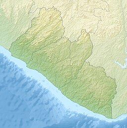
Relief location map of Liberia.
- Projection: Equirectangular projection, strechted by 101.0%.
- Geographic limits of the map:
- N: 8.8° N
- S: 4.0° N
- W: -11.8° E
- E: -7.0° E
- GMT projection: -JX16.933333333333334cd/17.102666666666668cd
- GMT region: -R-11.8/4.0/-7.0/8.8r
- GMT region for grdcut: -R-11.8/4.0/-7.0/8.8r
- Relief: SRTM30plus.
- Made with Natural Earth. Free vector and raster map data @ naturalearthdata.com.
Författare/Upphovsman: Fry1989, Licens: CC BY-SA 3.0
Flag of the Liberian county of Sinoe.


