Sheffield Township, Lorain County, Ohio
| Sheffield Township | |
| Land | |
|---|---|
| Delstat | |
| County | Lorain County |
| Höjdläge | 206 m ö.h. |
| Koordinater | 41°25′16″N 82°7′42″V / 41.42111°N 82.12833°V |
| Area | 6,22 km² |
| Folkmängd | 3 963 (2020)[1] |
| Befolkningstäthet | 638 invånare/km² |
| Tidszon | EST (UTC-5) |
| - sommartid | EDT (UTC-4) |
| ZIP-kod | 44055 |
| GNIS-kod | 1086520 |
Översiktskarta | |
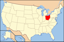
Ohios läge i USA | |
| Redigera Wikidata | |
Sheffield Township är en kommun (township) i Lorain County i delstaten Ohio, USA. Den gränsar bland annat till bykommunen Sheffield.
Referenser
- ^ United States Census Bureau (red.), USA:s folkräkning 2020, läs online, läst: 1 januari 2022.[källa från Wikidata]
Media som används på denna webbplats
Författare/Upphovsman: This version: uploader
Base versions this one is derived from: originally created by en:User:Wapcaplet, Licens: CC BY 2.0
Map of USA with Ohio highlighted
Författare/Upphovsman: Ruhrfisch and Nyttend, Licens: CC BY-SA 3.0
Map of the municipal and township boundaries of Lorain County, Ohio, United States, as of the 2000 census, with the location of Sheffield Township highlighted. Township borders are shown only in unincorporated areas in order to differentiate incorporated and unincorporated areas more clearly.


