Serrai (perifereiakí enótita)
| Den här artikeln behöver källhänvisningar för att kunna verifieras. (2023-07) Åtgärda genom att lägga till pålitliga källor (gärna som fotnoter). Uppgifter utan källhänvisning kan ifrågasättas och tas bort utan att det behöver diskuteras på diskussionssidan. |
| Serrai | |
| Regiondel | |
| Officiellt namn: Σέρρες | |
| Land | |
|---|---|
| Region | Mellersta Makedonien |
| Höjdläge | 448 m ö.h. |
| Koordinater | 41°10′00″N 23°30′00″Ö / 41.16667°N 23.5°Ö |
| Tidszon | EET (UTC+2) |
| - sommartid | EEST (UTC+3) |
| ISO 3166-2-kod | GR-62- |
| Geonames | 734329 |
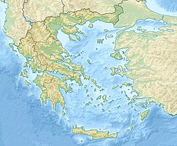
Läge i Grekland | |
Serrai är en regiondel (perifereiakí enótita), till 2010 prefekturen Nomós Serrón, i Mellersta Makedonien i norra Grekland. Huvudort är Serrai, övriga större städer i regiondelen är Maurothalassa, Nigrita, Nea Zixnis och Siderokastro.
Regiondelen är delad i sju kommuner. Den tidigare perfekturen var delad i 27 kommuner.
- Dimos Amfipoli
- Dimos Emmanouil Pappas
- Dimos Irakleia
- Dimos Nea Zichni
- Dimos Serres
- Dimos Sintiki
- Dimos Visaltia
Externa länkar
 Wikimedia Commons har media som rör Serrai.
- Regiondelens webbplats
| |||||||||||||
Media som används på denna webbplats
Författare/Upphovsman: Tkgd2007, Licens: CC BY-SA 3.0
A new incarnation of Image:Question_book-3.svg, which was uploaded by user AzaToth. This file is available on the English version of Wikipedia under the filename en:Image:Question book-new.svg
Författare/Upphovsman:
- Greece_location_map.svg: Lencer / derivative work: Uwe Dedering (talk)
Location map of Greece
Shiny red button/marker widget. Used to mark the location of something such as a tourist attraction.
Locator map of Srres prefecture (Νομός Σερρών) in Greece


