Scottsdale
- För andra betydelser, se Scottsdale (olika betydelser).
| Scottsdale | ||
| Stad (city) | ||
 Centrala Scottsdale, med Arizona Canal | ||
| ||
| Uppkallad efter: Winfield Scott | ||
| Land | ||
|---|---|---|
| Delstat | ||
| County | Maricopa County | |
| Höjdläge | 380 m ö.h. | |
| Koordinater | 33°29′35″N 111°55′34″V / 33.49306°N 111.92611°V | |
| Area | 477,7 km² (2020)[2] | |
| - land | 476,57 km² (2020) | |
| - vatten | 1 136 911 km² (2020) | |
| Folkmängd | 241 361 (2020)[3][4] | |
| Befolkningstäthet | 506 invånare/km² | |
| Grundad | 1894 | |
| Borgmästare | David Ortega (2021–)[1] | |
| Tidszon | MST (UTC-7) | |
| ZIP-kod | 85250–85271 | |
| Riktnummer | 480 | |
| GNIS-kod | 11029 | |
| Geonames | 5313457 | |
 Scottsdale i Maricopa County och Arizona | ||
 Arizonas läge i USA | ||
| Wikimedia Commons: Scottsdale, Arizona | ||
| Webbplats: https://www.scottsdaleaz.gov/ | ||
| Redigera Wikidata | ||
Scottsdale är en stad (city) i Maricopa County i delstaten Arizona i USA. Staden hade 241 361 invånare, på en yta av 477,70 km² (2020).[5][6]
Scottsdale är belägen i den centrala delen av delstaten, cirka 15 kilometer nordost om huvudstaden Phoenix. Den ingår i Phoenix sammanhängande storstadsområde.
Scottsdale Fashion Square är ett köpcentrum med över 225 butiker och med inriktning på märkesprodukter och lyxvaror.
Kända personer från Scottsdale
- Cody Bellinger, basebollspelare
- Emma Stone, skådespelare
Galleri
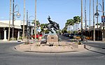 Scottsdale Arts District.
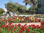 Gamla staden i Scottsdale.
 Stadshuset.
Referenser
- ^ läs online, www.scottsdaleaz.gov , läst: 23 mars 2022.[källa från Wikidata]
- ^ Gazetteer Files – 2020 (på engelska), United States Census Bureau, läs online, läst: 3 november 2021.[källa från Wikidata]
- ^ Explore Census Data – Scottsdale city, Arizona (på engelska), United States Census Bureau, läs online, läst: 3 november 2021.[källa från Wikidata]
- ^ United States Census Bureau (red.), läs online, läst: 1 januari 2022.[källa från Wikidata]
- ^ ”Explore Census Data – Scottsdale city, Arizona” (på engelska). United States Census Bureau. https://data.census.gov/cedsci/profile?g=1600000US0465000. Läst 3 november 2021.
- ^ ”Gazetteer Files – 2020” (på engelska). United States Census Bureau. https://www.census.gov/geographies/reference-files/time-series/geo/gazetteer-files.2020.html. Läst 3 november 2021.
Externa länkar
 Wikimedia Commons har media som rör Scottsdale.
- Officiell webbplats
| ||||||||||
Media som används på denna webbplats

Map of USA AZ.svg
Författare/Upphovsman: Huebi, Licens: CC BY 2.0
Map of USA with Arizona highlighted
Författare/Upphovsman: Huebi, Licens: CC BY 2.0
Map of USA with Arizona highlighted
Maricopa County Incorporated and Planning areas Scottsdale highlighted.svg
This map shows the incorporated areas and Indian reservation boundaries in Maricopa County, Arizona, along with water bodies and major highways and roads. Scottsdale is highlighted in red. Other incorporated cities are shown in gray, planning area borders for these cities and Indian reservation borders are shown as solid black lines. Changes from Previous Version: Updated the maps to include water bodies and to make "less boring" than the plain black/white/gray maps. Format was updated to match standards laid out by WikiProject Maps/Conventions. Map data is based on data from the following Webpage: Maricopa County Interactive GIS Map. I created this map in Inkscape.
This map shows the incorporated areas and Indian reservation boundaries in Maricopa County, Arizona, along with water bodies and major highways and roads. Scottsdale is highlighted in red. Other incorporated cities are shown in gray, planning area borders for these cities and Indian reservation borders are shown as solid black lines. Changes from Previous Version: Updated the maps to include water bodies and to make "less boring" than the plain black/white/gray maps. Format was updated to match standards laid out by WikiProject Maps/Conventions. Map data is based on data from the following Webpage: Maricopa County Interactive GIS Map. I created this map in Inkscape.
Scottsdale waterfront.jpg
Författare/Upphovsman: Joseph Plotz, Licens: CC BY 3.0
View of the Scottsdale Waterfront on a clear December day. Photo taken from the new pedestrian bridge connecting the Marshall Way shops with the Fifth Avenue arts district.
Författare/Upphovsman: Joseph Plotz, Licens: CC BY 3.0
View of the Scottsdale Waterfront on a clear December day. Photo taken from the new pedestrian bridge connecting the Marshall Way shops with the Fifth Avenue arts district.

20080409-ScottsdaleAZ-ArtsDistrict.jpg
Författare/Upphovsman: Bobak Ha'Eri, Licens: CC BY 3.0
Scottsdale Arts District in Scottsdale, Arizona
Författare/Upphovsman: Bobak Ha'Eri, Licens: CC BY 3.0
Scottsdale Arts District in Scottsdale, Arizona

20080409-ScottsdaleAZ-OldTown.jpg
Författare/Upphovsman: Bobak Ha'Eri, Licens: CC BY 3.0
Old Town Scottsdale in Scottsdale, Arizona
Författare/Upphovsman: Bobak Ha'Eri, Licens: CC BY 3.0
Old Town Scottsdale in Scottsdale, Arizona

Flag of Scottsdale, Arizona.svg
Författare/Upphovsman: TotallynormalAppalachian on fandom.com, Licens: CC BY-SA 3.0
Flag of Scottsdale in Arizona.
Författare/Upphovsman: TotallynormalAppalachian on fandom.com, Licens: CC BY-SA 3.0
Flag of Scottsdale in Arizona.

20080409-ScottsdaleAZ-001.jpg
Författare/Upphovsman: Bobak Ha'Eri, Licens: CC BY 3.0
City Hall, Scottsdale, Arizona
Författare/Upphovsman: Bobak Ha'Eri, Licens: CC BY 3.0
City Hall, Scottsdale, Arizona
