Sandersville, Georgia
| Sandersville | |
| city | |
Sandersvilles läge i Washington County och countyts läge i Georgia. | |
| Land | |
|---|---|
| Delstat | Georgia |
| County | Washington County |
| Koordinater | 32°58′55″N 82°48′34″V / 32.98194°N 82.80944°V |
| Yta | 33,3 km² (2010)[1] |
| - land | 32,9 km² |
| - vatten | 0,3 km² |
| Folkmängd | 5 912 (2010)[2] |
| Befolkningstäthet | 180 invånare/km² |
| Grundad | 1796 |
| Tidszon | EST (UTC-5) |
| - sommartid | EDT (UTC-4) |
| ZIP-kod | 31082[3] |
| FIPS | 1368208 |
| Geonames | 4221206 |
Ortens läge i Georgia | |
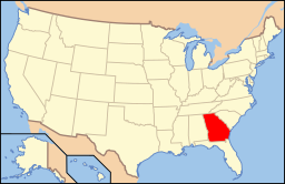
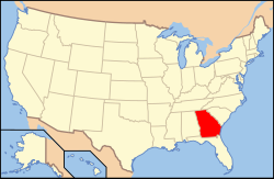
Georgias läge i USA | |
| Webbplats: http://www.sandersville.net/site/ | |
Sandersville är en stad i den amerikanska delstaten Georgia med en yta av 23,9 km² och en folkmängd, som uppgår till 6 144 invånare (2000). Sandersville är administrativ huvudort i Washington County.
Kända personer från Sandersville
- Elijah Muhammad, ledare för Nation of Islam 1934–1975
Källor
- ^ ”2010 Census Gazetteer Files”. US Census Bureau. Arkiverad från originalet den 14 juli 2012. https://www.webcitation.org/699nOulzi?url=http://www.census.gov/geo/www/gazetteer/files/Gaz_places_national.txt. Läst 14 juli 2012.
- ^ ”Sandersville (city), Georgia” (på engelska). State & County Quickfacts. U.S. Census Bureau,. Arkiverad från originalet den 21 juli 2012. https://www.webcitation.org/69KQ0giDZ?url=http://quickfacts.census.gov/qfd/states/13/1368208.html. Läst 21 juli 2012.
- ^ ”2010 ZIP Code Tabulation Area (ZCTA) Relationship Files”. U.S. Census Bureau. 26 augusti 2010. Arkiverad från originalet den 25 augusti 2012. https://www.webcitation.org/6ABdwXxbq?url=http://www.census.gov/geo/www/2010census/zcta_rel/zcta_place_rel_10.txt. Läst 25 augusti 2012.
Media som används på denna webbplats
Shiny red button/marker widget. Used to mark the location of something such as a tourist attraction.
Författare/Upphovsman: Arkyan, Licens: CC BY-SA 3.0
This map shows the incorporated and unincorporated areas in Washington County, Georgia, highlighting Sandersville in red. It was created with a custom script with US Census Bureau data and modified with Inkscape.
Författare/Upphovsman: Alexrk2, Licens: CC BY 3.0
Den här Det karta skapades med GeoTools.
Författare/Upphovsman: This version: uploader
Base versions this one is derived from: originally created by en:User:Wapcaplet, Licens: CC BY 2.0
Map of USA with Georgia highlighted


