Sanbornville
| Sanbornville | |
| CDP | |
Gafney Library | |
| Land | |
|---|---|
| Delstat | New Hampshire |
| County | Carroll County |
| Höjdläge | 177 m ö.h. |
| Koordinater | 43°33′15″N 71°1′51″V / 43.55417°N 71.03083°V |
| Yta | 4,1 km² (2010) |
| - land | 4,1 km² |
| - vatten | 0,0 km² |
| Folkmängd | 1 056 (2010) |
| Befolkningstäthet | 258 invånare/km² |
| Tidszon | EST (UTC-5) |
| - sommartid | EDT (UTC-4) |
| ZIP-kod | 03872 |
| Riktnummer | 603 |
| FIPS | 3367460 |
| Geonames | 5092346 |
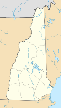
Ortens läge i New Hampshire | |
New Hampshires läge i USA | |
Sanbornville är en så kallad census-designated place i kommunen Wakefield i Carroll County i New Hampshire.[1] Vid 2010 års folkräkning hade Sanbornville 1 056 invånare.[2]
Kända personer från Sanbornville
- Freddy Meyer, ishockeyspelare
- William N. Rogers, politiker
Källor
- ^ Sanbornville, NH. Map Quest. Läst 25 juli 2021.
- ^ 2010 Census Population of Sanbornville, New Hampshire Arkiverad 25 juli 2021 hämtat från the Wayback Machine.. Census Viewer. Läst 25 juli 2021.
Media som används på denna webbplats
Shiny red button/marker widget. Used to mark the location of something such as a tourist attraction.
Författare/Upphovsman: Huebi, Licens: CC BY 2.0
Map of USA with New Hampshire highlighted
Författare/Upphovsman: Alexrk2, Licens: CC BY 3.0
Den här Det karta skapades med GeoTools.
Författare/Upphovsman: John Phelan, Licens: CC BY-SA 3.0
Gafney Library, Sanbornville New Hampshire


