San Pietro in Lama
| San Pietro in Lama | |
| Kommun | |
| Officiellt namn: Comune di San Pietro in Lama | |
| Land | |
|---|---|
| Region | Apulien |
| Provins | Lecce |
| Höjdläge | 43 m ö.h. |
| Koordinater | 40°18′30″N 18°07′43″Ö / 40.30843°N 18.12862°Ö |
| Yta | 8,20 km²[1] |
| Folkmängd | 3 533 (2017)[2] |
| Befolkningstäthet | 431 invånare/km² |
| Tidszon | CET (UTC+1) |
| - sommartid | CEST (UTC+2) |
| Postnummer | 73010 |
| Riktnummer | (+39) 0832 |
| ISTAT-kod | 075071 |
| Geonames | 6540768 |
| Skyddspatron | Petrus |
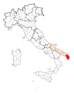
Kommunens läge i Italien | |
Kommunens läge i Lecce | |
| Webbplats: San Pietro in Lama | |
San Pietro in Lama är en ort och kommun i provinsen Lecce i regionen Apulien i Italien. Kommunen hade 3 533 invånare (2017).[2]
Referenser
- ^ ”Geomorphological characteristics of municipalities”. 2017. Arkiverad från originalet den 16 maj 2019. https://web.archive.org/web/20190516211155/http://dati.istat.it//Index.aspx?QueryId=34711. Läst 28 augusti 2019.
- ^ [a b] ”Statistiche demografiche ISTAT”. demo.istat.it. Arkiverad från originalet den 16 juli 2018. https://web.archive.org/web/20180716065929/http://demo.istat.it/bilmens2017gen/index.html. Läst 28 augusti 2019.
|
Media som används på denna webbplats
Författare/Upphovsman: Eric Gaba (Sting - fr:Sting) and NordNordWest, Licens: CC BY-SA 3.0
Blank physical map of Italy including the 08-2009 modification of the boundary between Emilia-Romagna and Marche regions, for geo-location purpose.
Shiny red button/marker widget. Used to mark the location of something such as a tourist attraction.
Map of the Provincia of Lecce.
Författare/Upphovsman: Lupiae, Licens: CC BY-SA 3.0
Chiesa Madre di San Pietro in Lama, Lecce
Map of the municipality (comune) of San Pietro in Lama (province of Lecce, region Apulia, Italien)


