San Miguel
San Miguel kan syfta på:
- San Miguel – spanska för helgonet Sankt Mikael
- Grupo Mahou-San Miguel – ett spanskt ölbryggeri
- San Miguel Corporation – ett bryggeriföretag i Filippinerna
- San Miguel Beermen – ett basketbollag ägt av San Miguel Corporation
Geografi
Angola
Antarktis
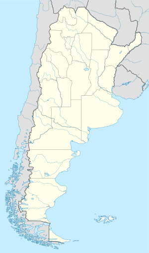
Argentina
- San Miguel kommun, Argentina, Corrientes, 27°55′00″S 57°30′00″V / 27.91667°S 57.5°V
- San Miguel, Corrientes, 27°59′45″S 57°35′23″V / 27.99585°S 57.58964°V
- San Miguel, La Rioja, 29°10′32″S 67°28′26″V / 29.17556°S 67.47399°V
- San Miguel, Catamarca, 28°08′23″S 66°12′18″V / 28.13978°S 66.20502°V
- San Miguel del Monte
- San Miguel de Tucumán
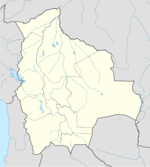
Bolivia
- San Miguel de Velasco
- San Miguel del Bala – ett litet samhälle i regnskogen vid floden Beni, nära Rurrenabaque
Brasilien
- Arroyo San Miguel (vattendrag i Brasilien), 33°36′14″S 53°31′57″V / 33.60394°S 53.53237°V
Se även
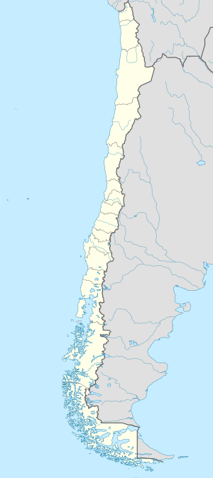
Chile
- San Miguel kommun, Chile, Provincia de Santiago, 33°29′57″S 70°39′06″V / 33.49907°S 70.65171°V
Colombia
- San Miguel kommun, Santander, 6°33′26″N 72°39′54″V / 6.55716°N 72.66509°V
- San Miguel, Santander, 6°34′33″N 72°38′45″V / 6.57583°N 72.64591°V
- San Miguel kommun, Putumayo, 0°20′35″N 76°54′36″V / 0.343°N 76.91°V
- San Miguel, Putumayo, 0°20′35″N 76°54′40″V / 0.34314°N 76.91124°V
- Cajamarca (ort), Tolima, 4°26′32″N 75°25′43″V / 4.44234°N 75.42874°V
- San Miguel de Sema (kommun), Boyacá, 5°33′N 73°45′V / 5.55°N 73.75°V
Costa Rica
Ecuador
- San Miguel de Salcedo, ort, Cotopaxi, 1°02′44″S 78°35′26″V / 1.04547°S 78.59063°V
- San Miguel, Bolívar, ort, 1°42′32″S 79°02′35″V / 1.70884°S 79.04311°V
El Salvador
- San Miguel, El Salvador, departementshuvudort, Departamento de San Miguel, 13°29′00″N 88°11′00″V / 13.48333°N 88.18333°V
Filippinerna
- San Miguel (Bohol), 9°59′13″N 124°20′28″Ö / 9.9869°N 124.3411°Ö
- San Miguel (Catanduanes), 13°42′00″N 124°17′00″Ö / 13.7°N 124.28333°Ö
- San Miguel (Leyte), 11°21′00″N 124°52′00″Ö / 11.35°N 124.86667°Ö
- San Miguel (Iloilo), 10°48′00″N 122°28′00″Ö / 10.8°N 122.46667°Ö
- San Miguel (Surigao del Sur), 8°50′00″N 125°59′00″Ö / 8.83333°N 125.98333°Ö
- San Miguel (Zamboanga del Sur), 7°41′55″N 123°15′57″Ö / 7.6987°N 123.2659°Ö
Se även
- San Miguel – gamla namnet på Cebu
Guatemala
- Municipio de San Miguel Ixtahuacán, kommun i Departamento de San Marcos
- San Miguel Ixtahuacán, kommunhuvudort, Departamento de San Marcos, 15°15′N 91°45′V / 15.25°N 91.75°V
Kuba
- San Miguel del Padrón – en stad och kommun i Havana
Mexiko

- San Miguel Zozutla, ort, Puebla, Yehualtepec, 18°45′18″N 97°39′15″V / 18.75501°N 97.65425°V
- San Miguel, Querétaro Arteaga, 20°52′07″N 99°57′42″V / 20.86857°N 99.96161°V
- San Miguel Contla, ort, Tlaxcala, Santa Cruz Tlaxcala, 19°21′40″N 98°07′57″V / 19.36111°N 98.1325°V
- San Miguel Quetzaltepec, ort, Oaxaca, 16°58′26″N 95°45′38″V / 16.9738°N 95.76045°V
- San Miguel Peras, ort, Oaxaca, 16°56′21″N 97°00′40″V / 16.93903°N 97.01119°V
- San Miguel Panixtlahuaca, ort, Oaxaca, 16°14′54″N 97°23′03″V / 16.24844°N 97.38427°V
- San Miguel Oxtotilpan, ort, Delstaten Mexiko, Temascaltepec, 19°09′03″N 99°53′10″V / 19.15083°N 99.88605°V
- Huautepec, ort, Oaxaca, 18°06′04″N 96°47′49″V / 18.10112°N 96.79704°V
- San Miguel Ecatepec, ort, Oaxaca, Magdalena Tequisistlán, 16°15′36″N 95°45′19″V / 16.26007°N 95.75531°V
- San Miguel Cajonos, ort, Oaxaca, San Francisco Cajonos, 17°09′59″N 96°16′21″V / 17.16639°N 96.2725°V
- San Miguel Balderas, ort, Morelos, 19°06′34″N 99°39′06″V / 19.10943°N 99.65165°V
- San Miguel Aloápam, ort, Oaxaca, 17°24′41″N 96°41′30″V / 17.41136°N 96.69154°V
- San Miguel Tenochtitlán, ort, Delstaten Mexiko, Jocotitlán, 19°45′37″N 99°55′21″V / 19.76028°N 99.9225°V
- Acambay, ort, Delstaten Mexiko, Acambay de Ruíz Castañeda, 19°57′19″N 99°50′34″V / 19.95518°N 99.84289°V
- San Miguel Marcos Pérez, ort, Oaxaca, San Juan Teposcolula, 17°37′50″N 97°23′31″V / 17.63057°N 97.39205°V
- Isla Soyaltepec (ort), Oaxaca, San Miguel Soyaltepec, 18°12′05″N 96°28′58″V / 18.20138°N 96.48278°V
- Zapotal San Miguel 1ra. Sección Ramal Uno, ort, Tabasco, Huimanguillo, 17°59′31″N 93°42′13″V / 17.99194°N 93.70361°V
- San Miguel, Villa Guerrero, 18°59′38″N 99°39′59″V / 18.99389°N 99.66639°V
- San Miguel, Chilpancingo de los Bravo, 17°14′07″N 99°50′08″V / 17.23525°N 99.83554°V
- San Miguel, Acayucan, 18°04′17″N 94°57′17″V / 18.0714°N 94.95474°V
- San Miguel, Villanueva, 22°02′02″N 102°51′07″V / 22.0339°N 102.85195°V
- San Miguel, Ocampo, 28°38′17″N 102°56′53″V / 28.63802°N 102.94799°V
- San Miguel Zapotitlan, ort, Sinaloa, Ahome, 25°56′54″N 109°02′51″V / 25.94831°N 109.04738°V
- San Miguel Totolapan, ort, Guerrero, 18°09′41″N 100°23′26″V / 18.16132°N 100.39049°V
- San Miguel el Alto, Jalisco, 21°01′48″N 102°24′15″V / 21.03011°N 102.40414°V
- San Miguel, Amatepec, 18°42′52″N 100°14′35″V / 18.71431°N 100.24306°V
- San Miguel de Buenavista, ort, Nayarit, Jala, 21°06′05″N 104°20′32″V / 21.10151°N 104.34223°V
- San Miguel, Amanalco, 19°15′49″N 100°01′48″V / 19.26361°N 100.03°V
- San Miguel, Ocosingo, 16°47′48″N 91°51′03″V / 16.79667°N 91.85083°V
- San Miguel, Tehuacán, 18°24′45″N 97°19′48″V / 18.4125°N 97.33°V
- San Miguel, Tepeaca, 19°04′06″N 97°51′20″V / 19.06833°N 97.85556°V
- San Miguel, Santiago Lachiguiri, 16°51′40″N 95°25′46″V / 16.86111°N 95.42944°V
- San Miguel, Puruándiro, 20°02′23″N 101°38′42″V / 20.03972°N 101.645°V
- San Miguel, Mezquitic, 22°04′13″N 104°19′16″V / 22.07028°N 104.32111°V
- San Miguel, Villa de Tututepec de Melchor Ocampo, 16°03′50″N 97°36′31″V / 16.06389°N 97.60861°V
- San Miguel, Ixhuatán, 17°19′29″N 93°03′01″V / 17.32464°N 93.05018°V
- San Miguel, El Bosque, 17°01′50″N 92°45′48″V / 17.03056°N 92.76333°V
- San Miguel, Tuzantán, 15°08′32″N 92°26′55″V / 15.14222°N 92.44861°V
- San Miguel, Medellín, 19°03′24″N 96°12′10″V / 19.05667°N 96.20278°V
- San Miguel, Teotlalco, 18°31′16″N 98°49′39″V / 18.52111°N 98.8275°V
- San Miguel, Tingüindín, 19°44′42″N 102°27′39″V / 19.745°N 102.46083°V
- San Miguel, Ayutla de los Libres, 16°59′40″N 99°05′46″V / 16.9945°N 99.09611°V
- San Miguel, Solosuchiapa, 17°25′31″N 93°01′28″V / 17.42528°N 93.02444°V
- San Miguel, Tonatico, 18°47′25″N 99°40′09″V / 18.79034°N 99.66906°V
- San Miguel, San Juan Lalana, 17°28′52″N 95°48′05″V / 17.48111°N 95.80139°V
- San Miguel, San Gregorio Atzompa, 19°00′58″N 98°20′30″V / 19.01621°N 98.34172°V
- San Miguel, Morelos, 19°58′47″N 101°27′19″V / 19.97972°N 101.45528°V
- San Miguel, Campeche, 19°18′12″N 90°27′58″V / 19.30333°N 90.46611°V
- San Miguel, Villa Comaltitlán, 15°07′22″N 92°33′37″V / 15.12278°N 92.56028°V
- San Miguel, Motozintla, 15°21′40″N 92°17′54″V / 15.36111°N 92.29833°V
- San Miguel, Las Margaritas, 16°31′26″N 91°57′28″V / 16.52389°N 91.95778°V
- San Miguel, Puebla, 18°55′14″N 98°15′06″V / 18.92065°N 98.25154°V
- San Miguel, Tasquillo, 20°33′10″N 99°17′31″V / 20.55278°N 99.29194°V
- San Miguel, Tapalpa, 19°53′41″N 103°41′41″V / 19.89472°N 103.69472°V
- San Miguel, Cacahoatán, 15°10′08″N 92°10′06″V / 15.16889°N 92.16833°V
- San Miguel, Acatepec, 17°19′42″N 98°51′34″V / 17.32821°N 98.85938°V
- San Miguel, Santa Cruz Zenzontepec, 16°34′44″N 97°27′43″V / 16.57889°N 97.46194°V
- San Miguel, Cuautitlán de García Barragán, 19°30′14″N 104°12′27″V / 19.50389°N 104.2075°V
- San Miguel, La Grandeza, 15°29′04″N 92°12′25″V / 15.48444°N 92.20694°V
- San Miguel, Zapotlanejo, 20°37′02″N 103°04′56″V / 20.61722°N 103.08222°V
- San Miguel, Zaragoza, 17°57′00″N 94°37′43″V / 17.95°N 94.62861°V
- San Miguel de Horcasitas, ort, Sonora, 29°29′15″N 110°43′29″V / 29.48737°N 110.72479°V
- San Miguel de Horcasitas (kommun), Sonora, 29°26′42″N 110°49′07″V / 29.445°N 110.81867°V
- San Miguel de Allende
Spanien
- San Miguel, Spanien, Kanarieöarna, Provincia de Santa Cruz de Tenerife, 28°05′54″N 16°37′01″V / 28.09826°N 16.61708°V
- El Cabo de Gata, ort, Andalusien, Provincia de Almería, 36°46′56″N 2°14′31″V / 36.78234°N 2.24198°V
- San Miguel de Serrezuela (kommunhuvudort), Kastilien och Leon, Provincia de Ávila, 40°40′14″N 5°17′19″V / 40.67064°N 5.28857°V
- Paradela (ort), Galicien, Provincia de Lugo, 42°46′00″N 7°34′00″V / 42.76667°N 7.56667°V
Se även
Media som används på denna webbplats
Logo for disambiguation pages.
Författare/Upphovsman:
- Guatemala Departments.svg: Daryona
- Mexico location map.svg: NordNordWest
- härlett verk: Spischot
Location map of Guatemala
Författare/Upphovsman: NordNordWest, Licens: CC BY-SA 3.0
Location map of Cuba
Författare/Upphovsman: Alexrk2, Licens: CC BY-SA 3.0
Location map Antarctica, Azimuthal equidistant projection
Författare/Upphovsman: NordNordWest, Licens: CC BY-SA 3.0
Location map of Chile
Författare/Upphovsman: Sémhur, Licens: CC BY-SA 4.0
Map of Mexico, with states borders.
Författare/Upphovsman: NordNordWest, Licens: CC BY 3.0
Location map of the Philippines
Författare/Upphovsman: NordNordWest, Licens: CC BY-SA 3.0
Location map of Brazil
(c) Eric Gaba – Wikimedia Commons user: Sting, CC BY-SA 4.0
Blank map of Costa Rica for geo-location purpose.
Note: The Isla del Coco, out of the map, is not shown.
Scale: 1:1,856,000 (accuracy: 464 m).
Equirectangular projection centered on 9°30'N – 84°15'W, WGS84 datum
Geographic limits of the map:
* West: 86°30'W
* East: 82°W
* North: 11°30'N
* South: 7°30'N
Shiny blue button/marker widget.
Författare/Upphovsman: NordNordWest, Licens: CC BY-SA 3.0
Location map of Bolivia
Författare/Upphovsman: NordNordWest, Licens: GFDL 1.2
Location map of Ecuador
Författare/Upphovsman: NordNordWest, Licens: CC BY-SA 3.0
Location map of Argentina
(c) Miguillen, CC BY-SA 3.0
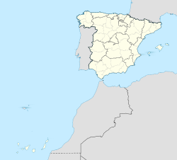
Location map of Spain with the Canary Islands
Författare/Upphovsman: NordNordWest, Licens: CC BY-SA 3.0
Location map of El Salvador

