San Javier
San Javier kan syfta på:
Argentina
- Departamento de San Javier (kommun i Santa Fe), 30°20′00″S 59°55′00″V / 30.33333°S 59.91667°V
- Departamento de San Javier (kommun i Misiones), 27°46′41″S 55°07′48″V / 27.77806°S 55.13004°V
- San Javier (kommunhuvudort i Argentina, Santa Fe), 30°34′40″S 59°55′54″V / 30.57781°S 59.9317°V
- San Javier (kommunhuvudort i Argentina, Misiones), 27°52′27″S 55°08′06″V / 27.87427°S 55.13509°V
- Departamento de San Javier (kommun i Córdoba), 32°05′00″S 65°10′00″V / 32.08333°S 65.16667°V
Bolivia
Chile
Mexiko
- San Javier, Durango, 24°49′52″N 106°18′33″V / 24.83106°N 106.3091°V
- San Javier (kommun), Sonora, 28°35′36″N 109°45′37″V / 28.59324°N 109.76026°V
- San Javier, Cadereyta de Montes, 20°45′09″N 99°43′04″V / 20.7525°N 99.71778°V
- San Javier, San Juan del Río, 20°27′15″N 100°03′43″V / 20.45417°N 100.06194°V
- San Javier, Puebla, Acajete, 19°07′18″N 97°56′50″V / 19.12179°N 97.94713°V
Spanien
- San Javier, Murcia, 37°45′48″N 0°46′12″V / 37.76341°N 0.77005°V
- San Javier (kommunhuvudort), Murcia, Murcia, 37°48′23″N 0°50′14″V / 37.80626°N 0.83736°V
Media som används på denna webbplats
Logo for disambiguation pages.
Författare/Upphovsman: NordNordWest, Licens: CC BY-SA 3.0
Location map of Chile
Författare/Upphovsman: Sémhur, Licens: CC BY-SA 4.0
Map of Mexico, with states borders.
Shiny blue button/marker widget.
Författare/Upphovsman: NordNordWest, Licens: CC BY-SA 3.0
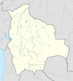
Location map of Bolivia
Författare/Upphovsman: NordNordWest, Licens: CC BY-SA 3.0
Location map of Spain
Equirectangular projection, N/S stretching 130 %. Geographic limits of the map:
- N: 44.4° N
- S: 34.7° N
- W: 9.9° W
- E: 4.8° E
Författare/Upphovsman: NordNordWest, Licens: CC BY-SA 3.0
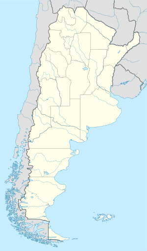
Location map of Argentina


